Monday, 3 September 2012

CYCLE TOURING BELIZE


BELIZE
303 Kilometres – 13 Days
19 August – 1 September 2012


19-20 August - Melchor de Mencos, Gautemala – San Ignacio, Belize - 18 kilometres

The Gautemala-Belize border was located on the outskirts of town and soon we found ourselves in tiny Belize. I say tiny as the country was about 290 kilometres long and 110 kilometres wide and had a population of about 320,000. Belize is the only country in Central America with a British colonial heritage. Therefore, it’s the single country where English is the official language, albeit with a heavy Caribbean accent. As a result, many Belizeans speak a mix of Creole and English among friends and switch to “full English” when speaking to foreigners. The strong Caribbean accent took time to get used to, but anyone could understand a friendly “gud mawnine”.

A short distance led to San Ignacio which sported a campsite right in the centre of town. As always, Ernest again needed bike spares after crossing the border. He looked around but couldn’t find a bike shop.

In the meantime, we met the bush doctor who recommended Noni juice for Ernest’s ailments. Later he returned with foul-smelling stuff in a jar. Ernest bravely drank it; lo and behold, would he not feel much better. I surmised he was given more than Noni juice.

I usually sleep well in my tent but this night was different. Red ants somehow got into the tent and I awoke to ants slowly and systematically devouring me.


21 August - San Ignacio – Belmopan - 40 kilometres

Belize is a relatively small country where nothing is very far, and people are friendly. Not only did a lady stop to give me a bottle of icy cold coconut juice, but a kind passer-by handed me a bunch of bananas. While waiting for Ernest to catch up at a bus stop, I had a long and interesting conversation with a lady waiting for her bus. The Belizeans were hospitable, chatty, and highly interested in where we came from.

A short cycle ride took us to Belmopan, the capital, a relatively small village instead of a city. Belmopan is a “built” city and was established in 1961 after Hurricane Hattie wiped out a considerable amount of Belize City. The town, therefore, appeared dead and the vast parks and gardens around the government buildings were deserted. We assumed we had to apply for a Mexican visa in Belmopan, but following enquiries at the embassy were told to apply in Belize City.


22 August - Belmopan - Belize City - 83 kilometres

While heading in the direction of Belize City, we, at last, reached level ground. But, as with flat areas, one always seems to be into the wind. Ernest nursed his bike along; as soon as he applied pressure to the peddles, the chain snapped.

We moved along slowly but still got to Belize City in good time, where we weren’t referred to as gringos, but as simply as “White Boy” or “White Woman”. LOL!

Belize City was significantly livelier than Belmopan and gave hope of finding a bike shop. We did indeed spot two shops but none had the necessary parts. Locating lodging was far easier, as kind Belizeans were ever ready to point one in the right direction.

The following morning was for visiting the Mexican embassy, and getting a visa was quick and uncomplicated. Not only was it fast but being issued a free six-month visa, instantly endeared me to Mexico. Afterwards, Ernest set out looking for a bike shop and, in the process, found nearly all the items he needed.

Trundling around town was rather interesting and music seemed everywhere. The Garifuna are master percussionists, and I was convinced I would know every Bob Marley song by heart upon leaving Belize.


24-27 August - Belize City – Caye Caulker - By water taxi (45min)

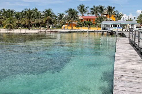
The place to go to in Belize was the islands. Water taxis plied the water between the mainland and the Cayes, and we jumped on one and sped off at full throttle across the calm Caribbean Sea to Caye Caulker. A welcoming and easy-going place where the motto was “Go Slow”.

Caye Caulker is a tiny island, at most 800m long and no more than 300m wide. Welcoming dreadlocked and laidback islanders eagerly await one as you step off the ferry, ready to point you in the right direction (or sell you the good stuff). While looking for a place to pitch a tent, we were pointed toward a nearby campground. The helpful gentleman mentioned that if he had a bike, he could’ve shown us the way – keep in mind we were almost in the middle of the 800m long island. LOL!

The Go-Slow motto of the island was taken quite literally. Being a teeny island, everyone knew each other. There was no rushing from place to place, as these friendly people made striking up a conversation easy. On the other hand, going to the little supermarket to pick up milk could be a lengthy process as everyone knew we had been cycling and hailed from South Africa, two facts that seemed to amuse them tremendously. They chuckled at the fact we were white and from Africa and they were black and from Central America. To them, it was even more amusing that we cycled to Belize, as the furthest most of them have been on a bike, was around the island.

We lazed the days away, dipping in the Caribbean's warm, crystal-clear water, listening to reggae music and sipping beer at the Lazy Lizard Bar. Finally, I gave in and took a boat to the nearby reef for a snorkel trip. I snorkelled to my heart’s content and swam with nurse sharks, stingrays, moray eels, and schools of fish. I wish I had a camera to capture the experience.


28 September - Caye Caulker – Belize City (by ferry) - Crooked Tree - 62 kilometres

Eventually, the time came to leave the island and return to the mainland. We were relatively slow in packing up but still managed to get the 10h00 water taxi to Belize City (it was a good thing it was late). After repacking the bikes, it was 12h00 by the time we departed and slowly made our way north.

About fifty-five kilometres further, a sign pointed to Crooked Tree and, as I found it hard to cycle past a place with a name like Crooked Tree, we made the detour. Down a rough dirt road of about six kilometres was the village of Crooked Tree, located on Crooked Tree Lagoon. The entire area had been declared a wildlife sanctuary for its birdlife. As accommodation was expensive, we asked to pitch our tents under a massive mango tree. All this happened to the great amusement of the villagers as they had never had such a request.


29 August - Crooked Tree – Orange Walk - 47 kilometres

We woke to the coarse croaking of a toucan and the chirping of various birds. It rained heavily during the night, making our patch somewhat muddy, and we dried our tents in the early morning sun before setting out to Orange Walk.

Orange Walk was a small but lively town, where one could still find old-fashioned tortilla factories. The settlement was situated along the banks of the New River, once a major waterway for the ancient Maya. A cabana next to the river, where the river was covered in water lilies and where little tables under thatched roofs were right in the water, was our peaceful abode for the night.


30 August - Orange Walk

The next morning, a boat ride took me up the New River to Lamanai, nearby Mayan ruins. The river trip was fabulous and provided an abundance of birdlife, crocodiles and monkeys.

Lamanai was simply magical. It’s one of the largest Mayan sites in Belize and holds over 800 structures. The site is situated deep in a tropical forest. I believe Lamanai was occupied as early as 1500 BC and remained so for over 3,000 years. Historians suspect its remoteness most likely contributed to its continuous occupation, well beyond other Mayan sites, until at least 1650 AD.


31 August - Orange Walk – Corozal - 53 kilometres

The ride to Corozal, the northernmost town in Belize, was short but into a headwind, past vast sugarcane fields. The wind grew stronger, and we opted for accommodation in Corozal. It was a good thing too, as no sooner had we offloaded, than the rain came bucketing down.

Later that evening, after the rain had subsided, a leisurely saunter took us to the square and supermarket. Not much happened in teeny Corozal and I contemplated investigating the nearby ruins. Still, it involved a boat ride and the sea was far too rough to undertake such a trip.


1-2 September - Corozal, Belize – Chetumal, Mexico – 27 kilometres

From our abode in Belize, a short 13-kilometre cycle led to the Mexican border, and one of the few times, we encountered a tad of a hiccup. Upon entering Belize, the immigration staff entered the wrong date in Ernest’s passport. In addition, their computer systems weren’t connected at the time, which was a problem for all involved. So, we waited patiently while phone calls and faxes went back and forth. Eventually, all were sorted out and we could proceed to Mexico.

On stepping over the border, I undoubtedly found myself in Mexico, a land of colour, sizeable American pick-up trucks, and Corona beer but minus the sombreros. Barely 10 kilometres further were Chetumal, the first city after crossing the border and a convenient place to draw Mexican pesos. Ernest needed bike spares (again), and all items were unearthed in the centre of town.
Saturday, 1 September 2012

CYCLE TOURING GUATEMALA


Guatemala
630 Kilometres – 15 Days
4 August – 31 August 2012

4 August - Copan, Honduras – Chiquimula, Guatemala - 65 kilometres

The ride to the Guatemalan border was easy and navigating immigration was uncomplicated. Two mountain ranges ran west to east, dividing the country into three major regions. No doubt Guatemala was going to provide another mountainous ride. We made our way along hilly valleys sporting dramatic scenery, which sounded more manageable than it was.

The route we followed headed toward Petén, a sparsely populated area and home to Tikal, one of the largest pre-Columbian Maya civilisation archaeological sites. Unfortunately, the weather remained sweltering, which made the going slow and exhausting.

Ernest realised his front rim was broken and searched for a new one in Chiquimula. He spent the remainder of the afternoon spoking it. Unfortunately, after all that work, he didn’t have enough of the right length spokes. Regrettably, there wasn’t any other option but to undo the whole shebang and use the spare rim he had been carrying.


6 August - Chiquimula – Rio Hondu - 36 kilometres

Almost 25 kilometres beyond Chiquimula was tiny Estanzuela. To our surprise, it had an interesting museum holding dinosaur and prehistoric whale bones from 30,000 years ago. Quite amazing.

Ernest still wanted to fine-tune the rim, and upon slinking into Rio Hondu we settled for a hotel. The place had rooms around a courtyard where he could work and we spent the afternoon watching the Olympics.


7 August - Rio Hondu – Quirigua - 65 kilometres

Between Rio Honu and Quiriqua was a short but relatively slow ride due to more bike repairs. For the best part of the day, the road followed a river through a magnificent valley with green mountains towering alongside, making it a very scenic ride. Unfortunately, the Carretera Atlantico was the main road between the capital and the coast and, therefore, a busy one, with 18-wheelers bearing down upon us like bats out of hell. I tried to stick as close to the side of the road as possible, but it remained nerve-wracking as the shoulder was often broken or obstructed.

In Quirigua, we detected another Mayan archaeological site we planned to visit the following morning. It appeared cowboy country where guns, big hats and leather boots were worn and sold practically everywhere.


8 August - Quirigua

The following day was spent at the Quirigua archaeological site, well-known for its huge statues or stelae (I was getting ever so clever with these names). The largest was 10.5 metres tall and the largest Maya stela known. Unfortunately, these stelae were housed under thatched-roof structures to protect them from further deterioration by the elements. It was, thus, challenging to get a good photograph.

Returning to the village, a shortcut led through banana plantations and past an old railway station. Unfortunately, only a dilapidated building and a few old rail coaches remained. Still, it was fun looking around. At the hotel, the lady was kind enough to do our laundry.


9-10 August - Quirigua – Rio Dulce – 74 kilometres

A reasonably comfortable ride led to Rio Dulce past lowlands and ranchos. In pretty Rio Dulce, situated on Lago de Izabal, we were surprised to spot many gringos; the reason being the popular and safe harbour for yachters. We located a guesthouse and stayed two days, allowing us to explore the region.

An easy and pleasant hike took us to the nearby El Castillo de San Felipe. Castles are always nice to explore as they usually have more than enough nooks and crannies to discover. The castle was built to keep pirates from looting the villages along Lake Izabel. Although it did the job for a while, the pirates soon captured and burnt the castle. The castle was, however, rebuilt and later used as a prison.


11 August - Rio Dulce – San Luis - 90 kilometres

The scorching weather and mountainous terrain made it exhausting cycling. Still, we pushed onwards the best we could, often stopping to fill our water bottles. In the process, the route entered the hot jungle province of El Peten. Regrettably, the jungle was fast disappearing as more and more land was cleared to accommodate planting oil palms or establishing ranches.


12-13 August - San Luis – Santa Helena – Flores - 120 kilometres

Early morning, our path continued up more hills. Finally, shortly beyond Poptum, the road levelled off and cycling became far more manageable.

Santa Helena was reached in the afternoon and we opted to stay in Flores. Our arrival in Flores coincided with the sun setting over Lago De Peten Itza on a scorching and very humid day. Flores is a stamp-sized tiny island, off the mainland and connected to the shore via a short (barely 500m) causeway. Finding an abode was easy as the tiny island was jam-packed with guest houses, hostels and restaurants. Our room was spacious and even had a little balcony overlooking the lake.

Ernest wasn’t feeling well and stayed in bed the following day while I trundled through Flores’ narrow cobbled streets. At sunset, I took a boat ride on the lake to see the island from a different angle.


15 August - Flores – Tikal - 67 kilometres

By morning, Ernest felt considerably better, allowing us to cycle to the famous Mayan Ruins of Tikal. Once again, it was boiling and hilly, on par with the rest of Central America.

However, Tikal is unique because it’s genuinely situated in the jungle. The park measures 550 square kilometres, and the ruins are in the middle of this vast jungle. It was another 17-kilometre cycle through a lush and dense tropical jungle from the park entrance before locating the campground. Upon seeing warning signs for snakes, jaguars, and other animals, we wondered if our plan of camping at the ruins was a good idea. The park housed a considerable number and variety of wildlife. It was a noisy night with hollering monkeys and raucous birds.


16-17 August - Tikal – Le Remate - 34 kilometres

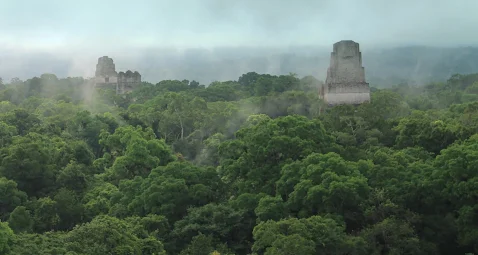
As soon as the gates opened at 6 a.m. we were there. The morning fog made it a magical walk through the dense forest, especially in other visitors’ absence. With its towering pyramids, the iconic Gran Plaza was half-hidden in the mist, giving it a ghostly appeal. Many temples had wooden staircases, allowing one to climb to the top to view these ancient structures rising above the treetops.

Once done, we returned to the tents, packed up and biked to Le Remate. Le Remate was another village near the lake and an excellent place to swim and relax. The next day Ernest updated his blog and I took the bus to Santa Helena to withdraw money and do the necessary shopping.


18 August - Le Remate - Melchor de Mencos - 69 kilometres

Up and down the hills, we went in the direction of Belize. Most of the way was paved, and the sections that weren’t were true dustbowls and trucks came roaring past in clouds of dust. It didn’t take long to get to the tiny border town of Melchor de Mencos and as Ernest still wasn’t feeling 100%, we settled for digs, did the shopping and kicked back in the shade for the remainder of the day.

Saturday, 4 August 2012

CYCLE TOURING HONDURAS


Honduras
1137 Kilometres – 26 Days
9 July – 3 August 2012


9-10 July – Ocotal, Nicaragua – Danli, Honduras - 57 kilometres

A slow slog led to Las Manos and the Nicaragua-Honduras border where we waved goodbye to Nicaragua with its volcanic landscape and colonial architecture.

Once across the border came a good descent into Danli, the first town in Honduras, a small but lively city with numerous cigar factories.

I didn’t feel well due to a chest infection and stayed another day. It was rather boring lying around doing nothing. Still, I considered it a good idea to stay put. I didn’t expect smooth riding in Honduras as the map indicated a mountainous country and little flat ground.


11 July - Danli – Zamporano - 65 kilometres

As predicted, our road slowly crept up the mountain for roughly 20 kilometres before descending into a valley of sorts. Upon clearing the valley, the road again took us up another mountain pass, and upon reaching Zamporano I had enough of hill riding for the day and called it quits. Our accommodation offered hot water, a sure sign we were at altitude. Good use of this luxury was made.


12-13 July - Zamporano – Tegucigalpa - 37 kilometres

From Zamorano we followed a hilly 37-kilometre ride over mountains to Tegucigalpa (teh-goos-ee-gal-pa) located in a valley at an altitude of 975m. Once over the mountain, it was a mostly downhill run into the city centre.

As is the case with the majority of Central American cities, Tegucigalpa’s centre consisted of a central plaza and church. The capital of Honduras wasn’t touristy and one felt a tad out of place. With no idea where to go, we hauled out the old Lonely Planet for recommendations.

The square was rather busy and interesting with loads of down-and-outs, street performers and “human statues”. I could watch them for hours, imagining it quite impossible to be that motionless for so long.

In addition to the main Cathedral was the fascinating Iglesia Los Dolores. One of its most remarkable features was its main facade. Built in Baroque style, with a central and two lateral towers, it was decorated by glazed terracotta sculptures and figures representing the Passion of Christ.

The city wasn’t known for its safety and many traders preferred to trade behind bars, not something which inspired confidence. Not only was the city dangerous, safety-wise, but the capital’s international airport, Toncontín, was notorious worldwide for its extremely short runway and the unusual manoeuvres pilots must undertake upon landing or taking off.

The following day was spent doing the usual rest day laundry, shopping and internet chores.


14 July - Tegucigalpa – Valle De Angles - 33 kilometres

Following a two-day stay in the city, a clean-shaven Ernest and I followed the road up the mountain. As foreseen, a steady and relatively steep climb led out of the valley. Then, following a 33-kilometre uphill ride and numerous stops to fill up with water, a small but interesting village named Valle De Angles signalled the end of the day’s ride.

The village was a former colonial mining town and offered an ensemble of old, restored buildings. The town was lively and where city folk came to spend weekends. Staying the night came easy as Ernest rightly remarked it’s probably called Valle De Angles as one likely needed wings to get out of there.


15 July - Valle De Angles – Gauimaca - 73 kilometres

Waking to the sound of macaws and green parrots is never a bad way to start one’s day and we resumed our ride over the mountains once more. Our route climbed sharply over the hills, and I sometimes doubted whether it was a good idea to have come this way. Again, the path descended into a valley and climbed over the next set of mountains.

Our chosen route was way off the beaten track, as we barely encountered any traffic, only the odd horse cart or ancient bus. Unsurprisingly, the paved road came to an abrupt halt, causing us to battle along a dusty and rutted path until eventually crawling into the junction town of Talanga.

You can imagine our surprise when we realised the approach road into the village was used as a drag racing circuit (police appeared as the timekeepers). Cars raced towards us like bats out of hell. Talanga seemed somewhat of a Wild West town with an ancient central plaza and dirt roads.

We continued up and over another set of mountains until Gauimaca came into view, a place that sported a simple lodge.


16 July - Gauimaca – Juticalpa - 86 kilometres

We awoke to a drizzle but it cleared and, although overcast, the rain stayed away. Shortly outside town, the paved road once again ended. Still, as inexplicably as it disappeared, it also reappeared, which set the day’s trend. Fortunately, the pine-forested hills weren’t as steep as the previous days.

In Juticalpa, I searched for an ATM but no machine wanted to dispense cash, and I was worried the card might be damaged. Ultimately, I settled for a rather expensive hotel where one could pay by card.

Villagers informed me the road to the coast was a dirt road and near-vertical in places. It wasn’t reassuring that they also indicated it was dangerous by pulling an imaginary gun and pointing two fingers to their temples. The area was well known as a drug trafficking route, but I didn’t think drug traffickers would bother us.

After all this happy news, a saunter to the supermarket revealed an ATM prepared to spit out a few Honduran lempiras. We stocked up with food as there appeared little along the lonely and sparsely populated 300-kilometre stretch to the coast.


17 July - Juticalpa – Wild camp - 43 kilometres

Shortly after departing Juticalpa, our route veered left at a heavily guarded turn-off. The road immediately started climbing up the mountain. After 20 kilometres, a settlement appeared where one could fill the water bottles. From there on, the road deteriorated and we struggled along a narrow dirt track, higher and higher. Still, the route climbed and we slipped and slid along a muddy, potholed road.

The going was dreadfully slow, and spotting a half-built structure we sought permission to set up the tents. The owner lived lower down the valley and was busy building a house closer to the road. This structure suited us as it provided camping out of sight of passing vehicles and offered running water. However, no sooner were the tents pitched than curious villagers came to witness this unusual event. Some peeped shyly around corners and others stared expressionlessly. Mothers brought their babies to point out these strange-looking foreigners. Eventually, it became dark and all headed home, leaving us to do our cooking.


18 July - Wild camp – San Esteban - 64 kilometres

Our crawl over the hills was no faster than walking pace. Around midday, the mud we encountered until then turned into clay and soon the bikes became utterly bogged down, eventually coming to a complete standstill. It became almost impossible to drag the bikes further as the wheels were jammed in the frame. I tried pulling it along but kept sliding down the hill and, in the process, broke my sole set of footwear. Eish!

Thankfully, nothing lasts forever and, shortly afterwards, the clay gave way to more manageable mud. At last, and after rounding a corner, one could see a vast valley below.

From there the road predominantly descended into the valley and into San Esteban, which offered accommodation. Luckily, the place had an outside tap, allowing for washing off most of the day’s mud and clay.


19 July - San Esteban – Village - 72 kilometres

A further uphill schlep of about 20 kilometres signalled the end of the climb, as from that point onwards the path steadily descended. Still, the going was incredibly slow as the path resembled a dry riverbed instead of a road. Stones, sand and deep ruts slowed the pace considerably and the traffic we encountered made no faster headway than us.

The area was rarely visited, and passing small indigenous communities and taking a camera out made kids run for their lives. You didn’t even have to take out a camera, as spotting us made them run for cover. We continued at a snail’s pace and wild camped by the side of the road shortly before sunset.


20 July - Unknown village – Saba - 80 kilometres

After a short cycle, the road spat us out at coastal lowlands amidst oil palm and banana plantations. Happy dance! We found ourselves back in the heat and humidity of tropical Honduras. Finally, we found the road not only paved but also flat, which made rolling into Saba early.


21 July - Saba – La Ceiba - 83 kilometres

Early morning, we tackled the last 80 kilometres to La Ceiba, located along the Caribbean coast and surrounded by lush jungles, mountains, broad rivers, and sandy beaches. Therefore, it wasn’t surprising that we had to climb yet another hill before finally arriving at the coast. Being a Saturday afternoon, the streets were jam-packed with cars and buses. It thus took weaving our way through hectic traffic to the city centre, where we found a place to stay. What a pleasure to flop down upon a bed!


22 July - La Ceiba

The following day was Sunday and the city centre dead quiet. A short stroll led to the beach for lunch and the rest of the day was spent chilling, doing truly little except laundry.

As La Ceiba was the gateway to the Bay Islands of Roatan, Utila and Guanaja, the plan was to take a ferry there the next morning. The island of Roatan was a well-known diving destination, whether snorkelling or scuba diving.


23 July - La Ceiba – Roatan - 27 kilometres

We loaded our mobile homes and cycled the short seven kilometres to the harbour, where a ferry waited to take us to the islands. The islands were located about 50 kilometres off the coast.

About an hour and a half later, the ferry dropped us at Dickson’s Cove. From Dickson’s, a 20-kilometre cycle ride brought us to West End, which had plenty of places to overnight, a few small shops, a lovely bay, and crystal-clear water.

Lodging was expensive, but Ernest set off on foot in search of something more reasonable. He returned with good news as he located digs offering a shared kitchen, veranda and hammock. The setup resembled a house as the kitchen was well equipped, providing a microwave, stove, toaster, coffee maker, pots and pans. Three rooms led off from the kitchen and we met Miriam and Doris (from Austria), two pleasant people with whom we shared the house.

Roatán is the largest of Honduras’ Bay Islands. It’s approximately 50 kilometres long and less than eight across at its widest point. The Mesoamerican Barrier Reef surrounds the islands, the most substantial barrier reef in the Caribbean Sea (second largest worldwide after Australia’s Great Barrier Reef).

The islands have a fascinating history as the English occupied the Bay Islands on and off between 1550 and 1700. Pirates used the islands as a safe harbour and English, French and Dutch pirates established settlements on these islands during that time. These pirates frequently raided Spanish cargo vessels carrying gold and other treasures, which the Spanish, in turn, stole from the locals. At one time, it was estimated over 5,000 pirates lived on Roatán. Imagine that!


24-25 July - Roatan

I searched for the dive shop, determined to do at least one scuba dive. Unfortunately, the dive could only be done the next day and instead I rented snorkelling gear. I snorkelled until my hands and feet were wrinkled. The water wasn’t simply warm but crystal clear and the reef was close enough to snorkel from the beach. I don’t think I had ever seen that amount of life and colour underwater.

Ernest and I hiked to West Bay in the morning, a half-hour walk along the beach. If possible, the beach at West Bay was whiter and the ocean bluer. The day was spent snorkelling and chilling.


26 July - Roatan – Dickson’s Cove – La Ceiba - 33 kilometres

We backtracked to Dickson’s Cove to catch the 14h00 ferry for the return trip to La Ceiba on the mainland. Once in La Ceiba, it made sense to return to our previous digs as it was centrally located in the town centre.


27-28 July - La Ceiba – Tela - 103 kilometres

The ride to Tela was effortless, and although extremely hot, it was relatively flat. We ambled on to Tela, where a comfortable bed was unearthed at Bertha’s. Ernest visited the supermarket for ingredients to concoct a salad. The salad turned out quite substantial and was loaded with olives, boiled eggs and avocadoes, all on a bed of lettuce.

Tela was a small, busy Honduran town featuring a lovely beach stretching several kilometres east and west. The town centre was a hive of activity with narrow, busy streets, a lively market and hectic traffic. However, I, strangely, felt quite at home.

A short meander along the beach brought us to La Ensenada. In this small indigenous settlement, carefree kids played in puddles and rustic restaurants served fresh seafood at the shore. Colourful fishing boats along the beach completed the picture.


29-30 July - Tela – San Pedro - 98 kilometres

After a relaxing two days, the ninety-odd kilometres to San Pedro was easy biking on a good road. San Pedro turned out a rather substantial city. Luckily, it was Sunday and the streets quiet.


31 July - San Pedro – Quimistan - 63 kilometres

After our morning cuppa, provided free at our guesthouse, we proceeded up the western mountains of Honduras. It seemed the road to Guatemala would again be through a mountainous region. We slowly headed up the valley which looked fertile, judging by the number of fruit vendors. Further up the mountain, a bamboo pipe squirted cool, crystal-clear water—perfect on a blistering hot day. Rolling into the small village of Quimistan around midday, we discovered accommodation offering a TV allowing us to watch the Olympics.


1 August - Quimistan – La Entrada - 55 kilometres

The ride to La Entrada was a short but boiling and hilly one and we opted for a hotel and again watched the Olympics for the remainder of the day. Not that there was a great deal more to do in La Entrada, as it was a hot and dusty crossroads town with hectic traffic zooming off in all directions.


2-3 August – La Entrada – Copan Ruinas - 65 kilometres

The stretch between La Entrada and Copa was well known for its coffee plantations and thus scenic albeit mountainous. Upon spotting one of these famous Copan coffee farms, we felt obliged to sample a cup of their famous high-grown coffee.

Ten kilometres from the Guatemalan border was the charming and tranquil village of Copan Ruinas, famous for nearby Mayan ruins. Finding accommodation was easy as just about every second building was a hotel or hostel.

I was up early as the gates to the archaeological site opened at 8h00 and it was my first visit to Mayan ruins. Although not the most impressive of Mayan ruins, it’s said to be one of great importance, dating to AD250–900. Archaeologists are still hard at work, discovering more and more structures. I liked the names of the early kings, Great Sun Lord, Waterlily Jaguar, Moon Jaguar, Smoke Jaguar, etc. Archaeologists are still unravelling what happened to the Maya at the end of the classic period and what caused the collapse and abandonment of these cities. The best evidence currently points to droughts around the 8th century.

Monday, 9 July 2012

CYCLE TOURING NICARAGUA


Nicaragua

511 Kilometres – 18 Days
21 June – 8 July 2012


Photos


21 June - La Cruz, Costa Rica – San Jorge, Nicaragua - 64 kilometres

From Costa Rica the road to Nicaragua veered inland away from the Pacific Ocean and onto the busy Costa Rico-Nicaragua border. Trucks were backed up for kilometres, still, our crossing into Nicaragua went smoothly. After crossing the border, one first noticed Lake Nicaragua, a substantial freshwater lake. We continued in the direction of Rivas, the first big(ish) village.

From Rivas, a smaller path led towards the lake where we discovered an inexpensive guesthouse in San Jorge, a tiny lakeside settlement. From here, ferries departed to Isla de Ometepe, an island fifteen kilometres off the mainland. Isla De Ometepe was formed by two volcanoes rising out of the lake. Concepcion (1 610m) is still considered active, but last erupted in 1957.

The most remarkable fact about Lake Nicaragua was that it was home to sawfish, tarpon, and sharks despite being a freshwater lake. Initially, scientists thought sharks in the lake belonged to an endemic species, the Lake Nicaragua shark. In 1961, following comparisons of specimens, the Lake Nicaragua shark was found to be synonymous with the Bull shark, a species also known for entering freshwater elsewhere. It had been presumed these sharks were trapped within the lake, but it was subsequently discovered they could jump along the San Juan River’s rapids (which connects Lake Nicaragua and the Caribbean Sea), almost like salmon. Bull sharks tagged inside the lake were caught in the open ocean (and vice versa). How amazing is that?


22 June - San Jorge - Isla De Ometepe - By ferry

On the car ferry across the lake to Isla De Ometepe, a waterspout appeared, not something I had witnessed before; what an incredible sight. It barely allowed us snapping a few pics and then completely disappeared.

From San Jose, it was a mere twelve-kilometre cycle to Moyogalpa, one of the bigger villages on the island. Not a great deal happen in these places, except for a few backpackers wandering about. The harbour was the busiest place where goods to and from the mainland were loaded and offloaded.

Street food appeared once the sun had set, and tables and chairs were placed along the sidewalk. Both islanders and visitors miraculously reappeared from their midday hideouts to enjoy the cooler evening air.


23 June - Isla De Ometepe

The island is tiny and, while exploring, I noticed a small path leading towards the lake, where we found a single cabana right on the lake shore. No one was getting me away from that spot. We swam, relaxed on our little veranda, and observed lakeside living, which had a surprising amount of activity. Seeing it’s a freshwater lake, islanders bathed, did their laundry, washed farm animals and fished.


24 June - Isla De Ometepe

Early morning was the coolest time of day and, as I woke early, I grabbed the camera and began exploring. I soon came upon villagers doing their chores. Ladies did laundry, men fished, and horsemen washed and broke in horses. I thought it all fascinating.

Once we checked out from our idyllic abode, a short but scenic cycle, which offered sensational views, took us to the opposite side of the island. The village of Altagracia was not merely home to a cathedral built in 1924, but it also featured giant ancient basalt rock statues. Eventually, we returned to Moyogalpa where we spent an additional night.


25-26 June - Moyogalpa – Granada - 78 kilometres

By morning, a ferry returned us to the mainland from where we proceeded to Granada. Granada came as a pleasant surprise as a plethora of restored colonial architecture lined its narrow streets.

Situated along the shores of Lago Nicaragua, Granada has a fascinating history. Its location along the lake gave it easy access to the Caribbean Sea via Rio San Juan but also made it an easy target for pirates. As a result, the city fell victim to many invasions from English, French and Dutch pirates.

Today, Granada is a peaceful, pretty city sporting a lovely mango tree-covered central plaza, many colourful restored houses, and quite a few impressive churches. The most remarkable was the cathedral at Parque Central. Our early arrival allowed us plenty of time to snatch a few pictures before sunset.

Grenada called for an additional day of investigating as it was blessed with countless attractions. Unfortunately, our establishment was incredibly hot and it was impossible to stay beyond sunrise. Eish!


26-28 June - Granada – Masaya - 21 kilometres

From Granada to Masaya, well known for its arts and crafts, was a short twenty-one-kilometre ride. It was also the most accessible place from where to get to the top of Vulcan Masaya.

A backpacker’s hostel made for easy exploring and we set off to the artists market, a vast walled structure with a warren of stalls selling everything from stuffed frogs to hammocks.

Far more interesting was the municipal market and bus terminus. This dusty place was fascinating and buses came and went in a seemingly chaotic fashion. The equally dusty market was jam-packed with traders, shoppers, food vendors, and scrawny-looking dogs. A place where one could find almost anything, from rice and beans to homemade cheese and handmade leather goods. Joining other Nicaraguans, we sat down to a plate of baho (plantain and beef stew), as it’s said that food becomes an adventure in a foreign country. Oi!

I tried making my way to Vulcan Masaya but could only find a guide for the following evening. It was fun, and the guide’s English was slightly better than my Spanish. However, I considered his vehicle far from roadworthy. I sometimes doubted whether we would reach the top as the drive was steep along a winding road. The poor car splattered and hiccupped but, eventually, we got to the lip of the crater.

The Santiago crater is an active crater billowing out thousands of tons of toxic gasses, causing acid rain and thus very little vegetation at the top. Folklore has it pre-Hispanic inhabitants of the area threw young women into the boiling lava to appease the goddess of fire. When the Spanish arrived, they called the crater the Gates of Hell and placed a cross overlooking the crater hoping to exorcise the demons who dwelled within.

The nearby bat cave was equally interesting and home to millions of vampire bats. Around sunset, these bats left the cave for food - an extraordinary sight.


29 June–2 July - Masaya – Managua - 30 kilometres

A short 30-kilometre cycle ride led to Managua, Nicaragua’s capital, where we came upon a somewhat disjointed city. The city had been subject to many natural disasters; the latest being a devastating earthquake in 1972, which destroyed the city centre. Managua was rebuilt around it with outlying shopping centres and markets. As a result, it took cycling around before locating the “traveller’s area” close to the old town. Sadly, the old city centre was derelict, with just the remains of an old cathedral visible. Interestingly, the clock still showed when the earthquake hit - at 12h35 midday.

As always, Ernest needed bike spares but couldn’t find a shop selling decent quality spares. However, we did get an address for one selling Shimano spares, but it was Saturday and already closed.

One of the exciting things in Managua was the Ancient Footprints of Acahualinca. These tracks consist of fossilised human footprints in volcanic ash and mud, solidified about 2,120 years ago. The footprints were buried four metres underground when unearthed and are still in perfect condition. The prints indicate a group of 15 people (men, women and children) en route to the lake. In addition to the human footprints, there are deer and raccoon tracks.

One can’t go far in Managua without seeing a statue of Augusto Nicolás Calderón Sandino, a Nicaraguan revolutionary and leader of a rebellion against Nicaragua’s US military occupation between 1927 and 1933. Of course, he was labelled a bandit by the United States government. However, his exploits made him a hero throughout much of Latin America, where he became a symbol of resistance to the United States’ domination.


3-5 July - Managua – León - 93 kilometres

The way to León, Nicaragua’s first capital, was significantly more challenging than anticipated. The road deteriorated and led along a hilly and potholed route. If I ever wondered what two tectonic plates smashed together looked like, this was probably it. I had no energy but battled on until reaching León, dehydrated and unwell.

León was very much a university town and graced by picture-perfect restored colonial architecture. Construction of León’s most famous building (The Cathedral) began in 1747 and lasted over a century. Today, the cathedral is the largest in Central America. According to legend, the city’s leaders feared authorities would turn down their original grandiose design and submitted a more modest but bogus set of plans.


6 July - León – San Isidro - 114 kilometres

From Leon, the road turned inland and headed towards the hills to San Isidro. Our day consisted of a slow slog up the mountain; mercifully, it came with a cloud cover and a mild gradient.

To our dismay, San Isidro turned out considerably further than the signboards indicated. At first, the distance was expected at most 90 kilometres, but the 90-kilometre mark came and went and still no San Isidro. Doubting whether we were on the right road, we eventually made it to tiny San Isidro where we bunked down at a hospidaje. Food was from a pavement eatery and I crawled in early as I wasn’t feeling 100%.


7 July - San Isidro – Esteli - 30 kilometres

A short but hilly ride took us to Esteli, a seeming cowboy town where one could find handmade leather boots and oversized belt buckles. The land around Esteli is perfect for growing tobacco used in cigars, and the town became a refuge for Cuban cigar makers following the Cuban Revolution in 1959. These award-winning cigars made Esteli one of the most significant cigar-producing cities in the world. Searching for these famous cigars was a relatively easy task. By evening, Ernest puffed away and declared it excellent quality.

Esteli was the scene of heavy fighting during the civil war against the Somoza government. Most of the town was destroyed during that time. Today, it’s a peaceful town featuring only a few murals reminding one of its not-so-peaceful past.


8 July - Esteli – Ocotal - 81 kilometres

Following an unhurried departure, our route proceeded to the Honduras border. Being firmly in the highlands, the road continued to be hilly. I thought it amazing what a difference 1,000-odd metres can make. The weather was substantially cooler at elevation and the best part of the morning was spent cycling in a drizzle, making it cool enough to don a windbreaker. Fortunately, the hills weren’t too extreme, and we encountered as many descents.

A comfortable abode off the Pan-Americana Highway made it an excellent overnight spot a mere 25 kilometres from the Honduras border.

Wednesday, 20 June 2012

CYCLE TOURING COSTA RICA


COSTA RICA
745 Kilometres – 22 Days
31 May – 20 June 2012


31 May - Paso Canoas – Palmar - 95 kilometres

Our first day of biking in Costa Rica provided exceptional vistas through thick and dense forests, making it an utterly enjoyable ride. Although scorching and humid, the landscape was scenic and less hilly than envisaged. So wet, hot and humid was it, conditions allowed farmers to grow rice.

The tiny river town of Palmar Sur was home to mysterious granite stone spheres dating back thousands of years to Costa Rica’s pre-Columbian period. While larger stones weighed as much as 13,000 kg, others were as small as bowling balls. The mysteriousness of these stones is mainly due to their perfectly spherical shape. Yet, to this day, I’m clueless about their use.


1-4 June - Palmar – Uvita - 45 kilometres

The coastal route between Palmar and Uvita didn’t run flush next to the coast, but it remained a gorgeous ride sporting plenty of ceviche traders and spectacular vistas.

Uvita’s unusual hostel had dormitories consisting of mosquito-netted beds in tree houses in gigantic mango trees. A pleasant kitchen area was where nearly everyone gathered to devour the many mangoes that fell to the ground. Our tents were pitched under cover, which prevented mangoes from falling on the tents. Uvita, situated within the Marino Ballena National Park, sported a flat, sandy beach stretching miles along the coast, which is blessed by crystal blue waters. So pleasant was it; three full days were spent in Uvita. A slack rope in the garden provided hours of fun, but none quite mastered it.


5 June - Uvita – Dominical - 23 kilometres

Costa Rica was unique in that it didn’t have a military. It must be one of only a handful of countries that doesn’t have an army (very clever, if you ask me). I hope its lack of military was a sign of a peaceful nation.

Costa Ricans are known as “Ticos”, and the Costa Rican currency is colón (plural colones) named after Cristóbal Colón or Christopher Columbus.

The ride to laid-back Dominical, a surfing community, was short and the remainder of the day was thus spent walking along the pretty, rocky beach, surrounded by dense forests.


6 June - Dominical – Quepos - 47 kilometres

Our path north continued past the dreaded oil palm plantations. Although a common cooking ingredient in parts of Africa, Southeast Asia and Brazil, it, by now, appeared planted almost wherever it would grow. Worldwide demand has increased tremendously; today, nearly all processed foods contain palm oil.

The removal of forests to make space for oil palm plantations has resulted in massive losses of natural forests, and one can understand the concern of environmental activists. However, I was not too fond of these plantations for an entirely different reason, as they always seemed planted in extremely hilly areas. The ride to Quepos, a small harbour town, was proof of this.


7 June - Quepos – Jaco - 66 kilometres

The ride to Jaco was scenic on a flat road alongside the coast. Jaco had a dilapidated campsite, close to its famous and beautiful beach. The coast was a real surfer’s paradise as the waves were good and the water warm. Supper was from a food stand, known as soda stands, the most economical eateries in Costa Rica. One could choose from various dishes; amongst them were always the ever-present rice and beans.

The weather was sweltering, and it was virtually impossible to be in a tent, but rain forced us into our private saunas. While lying there, sweat dripping, I could think of many more comfortable places to spend a night. Eventually, I crawled out in search of a cooling breeze, but there were none and the mosquitos were so fierce I had no option but to return to the tent. I couldn’t wait until morning to pack up and get out of there.


8 June - Jaco – Puntarenas - 76 kilometres

After studying the map, our assumption that it would be an easy ride along the coast was, clearly, incorrect. Although picturesque, the day’s ride had its fair share of hills. The heat was intense, and I swear I didn’t know my body contained that much fluid. Sweat poured out of my clothes to such an extent that one could easily have assumed I had a swim.

Eventually, the hilly route spat us out at Puntarenas, a strange town on a narrow, flat peninsula. Our nightly accommodation was in a basic wooden shack at the water’s edge. Across from our rickety abode was a pier where fancy passenger liners docked. Some people, clearly, travelled in more style than us.


9 June - Puntarenas – Tambor - 29 kilometres

By morning, we made our way to the small harbour to catch the ferry across the Golf de Nicoya to Paquera, situated on Peninsula de Nicoya. The peninsula is known for its gorgeous beaches and tropical rainforest. Therefore, I thought it worth investigating as it’s blessed with abundant fauna and exotic flora.

A quick ferry ride brought us to Paquera, and it immediately became apparent that riding wouldn’t be easy. The weather was humid and hot, and the narrow winding path led straight up a mountain. It wasn’t that the climb was high, but that the gradient was impossibly steep. Nevertheless, we wrestled our bikes up almost vertical inclines and slinked into Tambor soaked in perspiration. Despite the difficulty in reaching it, Tambor had a magnificent location along a horseshoe-shaped bay, and it dawned upon me that Costa Rica was indeed one of the world’s most scenic countries.


10-13 June - Tambor – Montezuma - 21 kilometres

The following morning, the route remained narrow and near-vertical in places. Barely twelve kilometres down the drag, a sign pointed to Montezuma Beach. Being curious about what was at the end of this potholed dirt track, we turned off to investigate. Seven kilometres further, the tiny beach village of Montezuma appeared. Hidden amongst dense forests, Montezuma was a true paradise and home to surfers and hippies alike. So laid-back was it that the place became known as Montefumar (‘fumar’ is Spanish for smoke). It was an excellent place to follow suit and swing in a hammock while puffing away for a few days.

We read books, swam in the ocean, and eventually trundled to a nearby waterfall. Doing little made the days fly by, and soon it came time to continue our journey.


14 June - Montezuma – Puerto Coyote - 40 kilometres

In the morning, I gasped up the sharp hill to the “main road”. So extreme was it that I had to walk the bike. Unfortunately, our joy getting to a paved section was short-lived as the path soon turned into a dirt road which later deteriorated into a muddy track.

Mercifully, the rivers we encountered weren’t deep and we could walk the bikes across. Thank goodness, my panniers were waterproof. The path became steep, muddy and rutted to such an extent that we had to help each other push the bikes up the near-vertical hills, as so slippery was the mud that we kept sliding down. LOL. We never saw a soul, and the single person we encountered was a chap asking for directions.

After what felt like hours, an idyllic beach emerged, and was made even more idyllic after a hard day’s riding along a muddy track. The tents were set up at the beach amongst palm trees, where one could wash the day’s mud away and watch the sunset over the ocean.


15 June - Puerto Coyote – Playa Carrillo - 46 kilometres

Our euphoria in reaching Puerto Coyote didn’t last long as the track continued up more hills, which worsened as the day progressed. The bikes again needed hiking up muddy and rutted paths (two to a bike) and I couldn’t believe another day was spent slip-sliding along these muddy trails. So sharp was the gradient we kept sliding down while wrestling our bikes up the slippery path. I couldn’t help but laugh at the sight we must have made, as there wasn’t a great deal one could do; we were in this mess and had to push on.

It felt like we were getting nowhere, and the kilometres increased instead of decreased. I was convinced we were on the wrong road. At a tiny settlement, we asked for directions and, in true Costa Rican style, were told to return to where the sign indicated right and turn left. Fortunately, it wasn’t far, as again it required pushing the bikes across a river and, low and behold, would there not be a paved road on the opposite side.

So great was our happiness, we booked in at the first opportunity. If ever one needed to “get away from it all”, Playa Carrillo would be your best bet.


16 June - Carrillo – Ostional - 51 kilometres

A paved road continued to the touristy beach of Samara. Again, a sign indicated to turn left but this time we first checked with villagers and, as anticipated, were told to go right.

Not long after departing Samara, the paved section again vanished and turned into a dirt track. Still, the day turned out considerably more effortless and, although rough, it had none of the severe hills of the previous day.

Our route led past numerous beaches, one more idyllic than the other, and tiny Ostional seemed an excellent place to call it a day. Unfortunately, it rained throughout the night, making me fear it would again turn our way into a mud bath.


17-18 June - Ostional – Playa Tamarindo - 67 kilometres

Upon waking, Ernest discovered nearly all his equipment left on the bike stolen: helmet, gloves, sleeping bag, etc. Strangely not the essential items. No one needs a sleeping bag in the tropics, and Ernest’s sleeping mat was punctured and thus useless. Amazingly, my bike with sleeping bag and tent was in front, weird. I surmised it wasn’t stolen but sold. Hahaha.

Eventually, we got going and found the road more level, and although not pan-flat, it made for comfortable cycling. Occasionally, the route followed the coast past magnificent surfing beaches, and at times it headed inland over hills through thick and dense natural vegetation.

Touristy Playa Tamarindo came as a pleasant surprise. I understood the surf movie, Endless Summer 2 was filmed in the area which firmly put Tamarindo on the map. Unfortunately, development took off at an alarming rate, to such an extent Tamarindo lost its Blue Flag status.

The sea turtles were long gone, but at least development seemed to have slowed, partly due to the recession and partly due to more control over new developments. Still, it remained a beautiful place and offered a convenient tourist infrastructure.

I enjoyed staying in a hostel as they usually provided Wi-Fi, fast food, and other touristy treats.


19 June - Playa Tamarindo – Liberia - 79 kilometres

There was no hanging about at pretty Tamarinda and after saddling up our iron horses, we headed over the hills to Liberia. The route turned away from the coast and led slightly inland. Biking along a paved road was a pleasure and the day came without the usual sharp hills.

Therefore, Liberia was reached in good time, where a comfortable abode made for relaxing the rest of the day. A nearby restaurant provided a typical Costa Rican meal consisting of rice, beans, meat, and a small salad.


20 June - Liberia – La Cruz - 60 kilometres

Once along the Pan-American highway, the route proceeded north toward Nicaragua. We continued through Parque Nacional Guanacaste, which meant it came with its fair share of hills; fortunately, an abundance of trees gave protection from the relentless heat. Digs in La Cruz allowed crossing the border into Nicaragua the next day.