PDF
USA (2) PART TWO
SEATTLE - BOSTON
22 May – 1 October 2014
8 173 Kilometres – 134 Days


PART TWO
24 June - 1 October 2014
6 473 Km - 103 Days

Washington (2)
Washington Photos
Oregon Photos
Idaho
Idaho Photos
Montana
Montana Photos
Wyoming
Yellowstone Photos
Montana (2)
Montana Photos
Wyoming (2)
Wyoming Photos
Minnesota
Minnesota Photos
Wisconsin
Wisconsin Photos
Michigan
Michigan Photos
Ohio
Photos Ohio
Pennsylvania
New
York
Photos New York
Massachusetts
Photos Massachusetts
PART TWO
24 June - 1 October 2014
6473 Km - 103 Days
Washington (2)
Seattle
First thing in the morning, I trundled to the Canadian Consulate, only to find they had no information about the visa process or how to collect it once granted. This lack of information left me with no choice but to continue eastwards through the northern states of the US until access to Canada was finally granted.
The weather was glorious and perfect for joining a walking tour, sampling their world-famous clam chowder and feeding seagulls while watching the sunset.
Seattle - Riverbend Camping - 90 km
Unable to cross into Canada, the time came to start the great trek east, first heading south towards Portland and then east via the Columbian Gorge. Looking at the map, it appeared an exciting ride.
Even though cloudy, the weather wasn't cold. Remarkedly, it was warmer in Washington than in San Francisco. Upon leaving, the route passed the Boeing factory, which didn't simply have a Museum of Flight but also one of Light, and I regretted not taking the Boeing tour.
Being cherry time, my path was peppered by stalls selling delicious cherries and I bagged a few sweet ones for the road.
Heading south on the old Pacific Highway, I came upon Riverbend campsite. The camp was expensive, and with an extra charge for a hot shower, it became the costliest shower I’d had so far.
Riverbend Campground – Lewis and Clark SP - 98 km
It rained throughout the night, and on waking, rain was still dripping on the tent, which made me curl up and sleep an additional hour until the rain abated. Packing up was a quick affair, and after donning rain gear, I hopped on my iron horse for the ride towards Vancouver. Albeit drizzling occasionally, the ride was enjoyable, partly along a bike path that ran through the woods for almost 15–20 miles.
A supermarket made stocking up in Toledo convenient, followed by the regular search for a camping spot. The nearby Lewis and Clark SP was a lovely place in a forest, although a few rather strange noises echoed from the woods. By evening, I zipped up the tent and hoped nothing would carry me away, seeing I was the only one there and their choices thus a tad limited.
Lewis and Clark SP – Vancouver - 108 km
The drizzle that woke me continued all day and, as a result, I made barely any stops, and the camera never came out. With few options left, I pulled my cap low and headed towards the next campsite.
Stopping at a Burger Hut to have lunch was a treat, if only to people-watch. Some, obviously, already had a few burgers too many, and the last thing they needed was one more massive milkshake. I thought America’s massive portions, which bordered on rudeness, were to blame for much of the health issues in the country.
Once on the road, it started drizzling, so I turned into the first inexpensive-looking establishment to escape the weather.
Oregon (2)
Vancouver – Portland - 60 km
Vicki, a 365-project friend who lived in Portland then, invited me to visit. Packing up was at leisure, as the ride to their house was only a short distance. Vancouver's Old Fort begged to be explored, and afterwards, I looked for a bike path across the Colombia River.
The weather was glorious, and the bike path next to the river was jam-packed with cyclists. A stop at Blue Lake Park, a large scenic area, was a great place to eat my takeaway. People were out and about, kids were swimming, and all enjoyed the excellent summer weather.
Locating John and Vicki's place was uncomplicated, and these fantastic people treated me like royalty. They didn't simply offer me a bed but treated me to supper at a floating restaurant. Then, at home, we chatted nonstop while my laundry was done. How awesome is that?
Portland – The Dalles - 123 km
The following day was lovely as the sun was out and one could wear shorts. I waved goodbye to John and Vicki and continued my journey along the Columbia River.
The way east led through the Columbia River Gorge and followed the Historic Columbia River Highway. The ride was stunning past numerous waterfalls and scenic areas. Vicki packed plenty to eat, and maybe it was those chocolate chip cookies that made me ride all the way to The Dalles, a small settlement along the river.
The Dalles - 32 km
I emerged with a sore throat and could feel a nasty cold taking hold. I had no patience for these minor illnesses and hoped it would disappear overnight. (Don't we all?) But, pedalling out of town, a stop at Safeway provided medicine, claiming to clear a cold in record time.
Feeling positively rotten, I cycled a meagre 30 kilometres to the next campsite—a pity as the weather was great and the day wind-free. People informed me that the Gorge was a notoriously windy area, and one could merely hope the wind-free weather would last until the following day.
The Dalles – Boardman - 114 km
Still feeling under the weather, staying one more day was enticing, but my restlessness got the better of me. With the wind in my favour, packing up was a speedy affair. A strong tailwind made for effortless riding toward Boardman—a good thing too, as I was feeling downright terrible.
Boardman had a beautiful campsite offering a luxurious lawn right on the Columbia River. The nearby shops provided a stack of food, but I had no appetite and just ate the salad.
The pedal or bottom bracket on my bicycle made the most ungodly noise, and I could only hope it would get me to the next village, roughly 30 miles further.
Boardman – Pendleton & Shuttle bus to La Grande - 100 km (& 45 miles by shuttle bus)
The next morning, a short bike ride took me to a surprisingly well-stocked bike shop for such a small community. After replacing the pedals, I rolled into La Grande early, with the wind at my back.
As soon as the road left the Columbia River, the landscape changed to vast plains where my path took me through endless wheat fields. Still suffering from a cold and not feeling too energetic, I pushed over the hills and soon spotted Pendleton far down in the valley.
In Pendleton, signs indicated the stretch between Pendleton and La Grange was off-limits to bicycles due to maintenance work. However, this was well-organized America, and a shuttle bus operated between the two towns. Unfortunately, the bus departed at 17h00, leaving a long wait. Once in pretty La Grange, I weakened at the sight of a motel room, which made it easy to kick back for the rest of the evening.
La Grange – Baker City - 72 km
The cold and flu medicine I bought didn't quite live up to its claim of relieving the symptoms super-fast, and, still feeling dreadful, I continued along Highway 84. Once at the top of the hill, the tarmac stretched miles ahead towards the historic town of Baker City, and I had a strong suspicion that this would be the last flat section for a while.
Feeling positively rotten, the Eldorado Inn made a good enough place to spend the night. It was Independence Day, and I thought it was a pity that I felt as awful as I did. Though all countries celebrate their independence, no country celebrates the day with as much gusto as the Americans.
Waking up with a blocked nose, heavy head and a tight chest, I knew there was no point in cycling. Instead, I sauntered to the shop, got more flu tablets, and returned to bed for two full days, realising that no amount of cycling was going to chase the flu away.
Baker City – Ontario - 135 km
At last, my cold abated, allowing me to pedal out of Baker City. The road followed the Old Oregon Trail, an old wagon route and emigrant trail that ran from east to west across the country, remarkably similar to the Great Trek in my home country.
The landscape also reminded me of South Africa as it very much resembled the Karoo. The route passed through sleepy hamlets featuring abandoned train stations, a railway line, a pub and church—the only thing missing was a forlorn-looking Pepper Willow.
I followed the Snake River, and with such a name camping along the riverbank wasn't on top of my to-do list. However, the weather was perfect, around 30°C during the day – ideal for cycling. I was on a bit of a downhill run and continued towards Ontario, the last stop before crossing the border into Idaho.
Idaho
Ontario – Boise - 97 km
Once across the state border into Idaho, my path continued until reaching the turnoff to Boise. Then, being invited by Rachel and Patrick, two Warm Showers hosts, I headed downtown and followed the Greenbelt bike path into the city centre. From the city, a short ride led to Rachel and Patrick's home. I've never met them personally and merely knew them from social media, as they were seasoned cycle tourers. Not only did they have a beautiful home, but they were the most likeable people imaginable. We chatted forever, and I was easily convinced to stay another day.
Patrick was born and raised in The Netherlands, and as Holland played in the World Cup Soccer semi-finals, we visited the pub to watch the game. Regrettably, Holland lost, but we all had a great time.
Rafting
I was invited to join Rachel and Patrick on a river rafting trip along the Wallowa and Grande Ronde Rivers. This was a fantastic opportunity, and I seized it with both hands. The drive to the start, and where we camped, was a long one. The following morning, we packed the rafts and took to the water. I joined Bobby (and his dog, Trixi), Gordy was on his own, Rachel and Patrick were in one boat, and Bob, Ivy and Eve (and Bob's dog) in another boat. They were all charming people and we had a total blast on the river.
The weather played along, and with temperatures soaring into the high 90s, the river was the perfect escape. Bob and Bobby fished occasionally, and whatever was caught went straight back into the river.
We camped along the riverbank in the evening, and I was impressed by their conservation efforts as not a single scrap of anything was left behind at the places we camped. They were incredibly well-organised, and one could tell this wasn't their first time on the river—even the dogs had lifejackets.
Time flew by, and all too soon it was time to load the boats and head to the city.
Boise
I intended to use my day in Boise productively and do something useful, like washing the sleeping bag. Instead, the day was spent playing with the camera in Rachel and Patrick's lush garden and enjoying the novelty of being in a real home. By evening, Sarah (another cyclist) arrived. We’d supper together, after which I packed my bags and prepared to resume my quest anew.
Boise – Glenn's Ferry - 125 km
In the morning, I thanked Rachel and Patrick, and intended to turn off at Mountain Home onto Route 20. But, the wind picked up, and I soon found myself grinding into a headwind. There and then, I made a U-turn and continued along Route 84.
The area was highly desolate and had very little of interest. However, a strong tailwind blew me into Glenn's Ferry early. At the Three Islands SP, the camping fee was astronomical (as Patrick warned) and it was best to look elsewhere.
Glenn's Ferry turned out a fascinating place. Back in the day, the area was one of the most famous and treacherous river crossings on the Oregon Trail. Not only was Glenn’s Ferry steeped in history, but it turned out to be the home of Equine Dentistry. You learn something new every day!
Glenn's Ferry – Truckstop - 109 km
This was the first day since departing Seattle that I encountered a headwind. Unfortunately, my hopes of it changing never materialised, and the wind direction stayed east-north-east all day. As a result, the going was relatively slow. Petrol stations made convenient distractions to break the monotony and fill the water bottles.
Not a significant amount happened, except riding through the Snake River Gorge which stretched almost 50 kilometres and was highly picturesque. The gorge was famous for Evel Knievel’s failed attempt to jump across it in a Skycycle rocket —a daring stunt that didn’t quite go as planned! The things people do! (Maybe I shouldn’t say that out loud, hahaha)
Truck Stop – American Falls - 135 km
Powered by a tailwind, I flew past farmlands and windfarms, indicating the area a notoriously windy one. Then, finally, Route 84 (which I’d been following for some time) turned south, and I veered north along Route 86, in the direction of both Canada and Yellowstone National Park. Overnighting was at the small settlement of American Falls, so named after a party of trappers whose boat went over the falls. Poor souls.
American Falls – Idaho Falls - 130 km
Not only was the day ideal for riding, but I was also lucky enough to have a tailwind pushing me along. From Pocatello, the road headed north through the Indian reservation of Fort Hall and past Blackfoot, which didn't have much going on apart from a potato museum. Of course, you know there's little happening in a place that boasts a potato museum.
Dave's Bike Shop, in Idaho Falls, changed the inner tube and discovered what was causing the slow puncture. Not simply did they change the tube but they did so free of charge.
I then searched for an inexpensive room, which was more difficult than expected. The one I located was far out of town, and once the panniers were off-loaded, it took biking back to the village to find food.
Idaho Falls – Warm Waters campsite - 110 km
The ride was so monotonous that I found myself listening to stories I had downloaded on my iPod—a novel way to cycle, but only possible when there’s no traffic. The path east ran past vast fields of seed potatoes and even more extensive wheat areas, and in the process, I met a French family pedalling around Idaho. Sadly, their holiday was soon ending, and they planned on hiring a car to tour Yellowstone National Park.
Arriving early at Warm Waters campsite meant I could spend the rest of the day basking in the sun. Warm Waters was a popular site, and campers floated downstream on inner tubes, only to run back and repeat the process. The camp had a great location next to the river, with plenty of trees. There were, surprisingly, no showers, but I guessed that was what the river was for.
Montana
Warm Rivers Campsite – Western Yellowstone – 95 km
By crossing the continental divide, one entered the state of Montana, and it's understood the name was derived from the Spanish word 'Montaña' (mountain). I, therefore, guessed the ride would include a few hills.
Montana ranks fourth in size but only 48th in population density out of the 50 states in the US. Even more unique is that the western third of Montana contains 77 named mountain ranges, forming part of the Rocky Mountains. I sincerely hoped not all 77 were on my path.
West Yellowstone had a campsite and a supermarket, and I spent the following day doing routine rest-day chores. The best part of the day was spent lazing about, which was a good thing, too, as a storm passed, complete with an impressive display of thunder, lightning, and hail.
Wyoming
West Yellowstone – Norris campsite - 52 km
I had a slow start as the day was meant to discover new things and not do distance, and I was bursting with excitement to investigate this unique region. At the entrance of Yellowstone Park, the entry fee was a meagre $12 (valid for seven days). Soon, the road crossed into the state of Wyoming, where a significant part of the park is situated. The day was fantastic, and the vistas surpassed all expectations. Yellowstone is truly one of a kind, a place where the earth bubbles, splatters and steams. Geysers erupted before my eyes—it was one of the most surreal places I’ve visited.
Camping was at Norris where a British family travelling the area told me an online visa application to Canada takes two months. At that point, I had little hope of securing the visa that would allow me to cycle through Canada.
Norris Campsite – Gardiner - 42 km
The ride was short but fascinating and included many stops at extraordinary sights. That night, I camped at Gardiner to rethink the route as the wind picked up. The forecast was for 35 m/h winds in an easterly direction. The idea of exploring Glacier National Park went right out the window—I had no intention of battling that kind of wind.
Montana (2)
Gardiner – Big Timber - 152 km
The weather forecast turned out to be spot-on, and the wind grew stronger as the day progressed. With a near-gale-force wind in my back, cycling was like low flying, reaching almost 60 km/h - scary stuff. From Gardiner, my path headed north towards Livingston from where it veered east.
Amazingly, once in Livingston, the direction of the wind changed, and it remained a tailwind. Arriving in Big Timber was thus in good time, and the lack of camping made me opt for a motel.
I decided to stay, follow the wind, and go wherever it blew me. I also sent an additional email to the Canadian visa office, inquiring exactly how long the visa would take and how one would receive it. In the meantime, the plan was to head further east while staying close to the border in case the visa came through.
Big Timber – Laurel - 112 km
The route followed the Yellowstone River—I understood it was the US's longest undammed river. Unfortunately, the wind wasn't as strong as the day before, and my legs felt tired following the previous day's long cycle.
On reaching Laurel, I called it a day but guessed one could easily have carried on towards Billings (a further 22 miles). But, as they say in South Africa, I didn't want to pull the ass out of the chicken.
After a good look at the map, I decided to head toward Mount Rushmore National Park as I’d given up hope of ever getting the Canadian visa. There was no word from them, not even a ‘Thanks for your payment’. Just a pathetic automated email stating they had received the application and would contact me in due time.
Laurel – Hardin - 105 km & 52 km
The room was cheap, likely due to its location near the railway line. Still, it was a good deal as the price included a complimentary buffet breakfast. My neighbours complained about the noise from the trains, but I never heard anything.
The way to Billings veered slightly southeast toward Mount Rushmore and was dreadfully monotonous. It was hot, dry, and somewhat lonely, sporting views of endless wheat fields. The only flicker of excitement was a flat tyre, courtesy of some stray debris on the road.
The first settlement was Hardin, where a campsite and a few places to eat had my name on them. So, after obtaining the usual evening beer and crisps, it was time to set up camp.
The following morning, after biking nearly an hour, I realised I had left my solar charger and phone behind and had little choice but to return to camp. Upon my return, I found the owners frantically phoning around to locate me. The Americans were such helpful people. Being already late, I considered it best to stay one more night and was promptly invited to a BBQ.
Hardin – Ranchester – 120 km
The going was slow as the ride was slightly uphill and into a mild breeze. However, the scenery offered little variation as I cycled past familiar scenes of endless wheat fields. Interestingly, harvesting wasn't done by the farmers but by harvesters. I further learned that the harvesters working in this area employed at least six South African youngsters to drive the harvesters.
Shortly before Ranchester, the road crossed into the state of Wyoming. Tiny Ranchester was pretty close, but the ride took practically the entire day. I crawled into camp dead tired—it was one of those days.
It rained through the night and still drizzled by morning, so I decided to stay put. The weather cleared, allowing hiking to the river and onto the old Connor battlefield. It's immensely sad when an entire tribe is wiped out. It’s final—no amount of money can ever undo it no matter how desperately you wish it could.
Tiny Ranchester had no shops except a small store at the gas station, a gunsmith, a taxidermist, and no less than two churches. The village was also home to the Cowboy State Bank, and I wasn't sure I would put my hard-earned money in a Cowboy Bank. During my walkabout around the village, I encountered two people who prayed for my soul. I must’ve seemed an absolute wreck.
Wyoming (2)
Ranchester – Buffalo - 95 km
Feeling miles more energetic, my route followed the old Black Diamond Trail, referring to yesteryear's coal mining industry. Although the peak mining years were long gone, some mining was still done in the area.
The road climbed slowly along the foothills of the Bighorn Mountains to Buffalo. Once there, it took pedalling around to locate a camping spot. There were at least two campgrounds, but both were relatively expensive. Ultimately, I settled for Indian Campground, which offered a small discount. Then, off to the shops for my nightly rations. LOL.
Buffalo – Gillette - 115 km
The weather forecast predicted a headwind, but the breeze turned out not too severe, and around midday it changed in my favour. Unfortunately, the stretch between Buffalo and Gillette was extremely barren, without a hamlet or farm. Thank goodness for a rest area to fill the water bottle before continuing to Gillette.
Here, I met a family (mom, dad and two kids) who enquired about my comings and goings. They were clearly a conservative family and dad the boss, as he did most of the talking while his wife remained one step behind, and the kids one step behind her. One of the first questions asked was, "What's your religion?" On answering, "I'm an atheist", the family retreated in unison in shock and horror. The only thing the man didn't do was spread his arms in a protective gesture to seal his family from this evil force. Afterwards, I was sorry for my reply as it instantly alienated me, and killed a conversation that could’ve been interesting. At times, it's better to go with the flow.
Gillette – Upton - 89 km
My late departure was not merely due to chatting with other campers but mainly due to predictions that the wind would change in an easterly direction at around 10 a.m. I had an Egg McMuffin and coffee at McDonald's, and by the time I was done, the wind indeed shifted east.
The ride to Moorcroft was pleasurable and I turned left onto Route 16. Before leaving, I stopped at the tiny West Texas Trail Museum to explore before continuing in the direction of Upton.
Clouds gathered overhead, and with thunder rumbling in the distance, I pedalled as fast as my legs could manage. A sign stated: "Upton, the best town on Earth." The statement might’ve been a tad of an exaggeration as Upton's population was a mere 1,000, and even that number was most likely for the "greater" Upton area.
Mercifully, Upton had the Weston Inn Motel, which I spotted just as the heavens opened. The owner offered me a room at half-price, making it the same price as camping. He further allowed me to use the washing machine—such a kind man. (Or was it perhaps due to the smell?)
Upton – Custer - 103 km
The following morning, the sky was clear and Route 16 continued past oil fields, apparently the oldest in the area. The oil must be exceptionally shallow, as the drills were half-sized. My path continued toward Mount Rushmore, and once past Newcastle, it swung east toward the Black Hills. Not only was the ride hilly and into a gusty breeze, but a swarm of horse flies descended on me, and being uphill, I couldn’t out cycle them. Ouch, ouch, ouch!
The KOA campsite outside of Custer appeared a good enough place but I was utterly shocked at the price! The Sturgis Bike Rally was in full swing, and every campsite was packed—it was no wonder the remaining few spots came at a hefty premium. Even sadder was to find they only sold beer in 24 packs. At least the shower was decent but what a steep price to pay to feel clean again. I was tired and in no mood to talk to anyone. (As if it was their fault the camp was expensive, and beer sold in 24 packs.)
South Dakota
Custer (1620m)– Rapid City (976m) - 87 km
The first stop of the day was at the immensely impressive Crazy Horse Memorial—a mountain carving of Crazy Horse (an Oglala Lakota warrior).
The monument is under construction and carved out of Thunderhead Mountain, land considered sacred by Oglala Lakota. The sculpture's final dimensions are planned at 641 feet (195 m) wide and 563 feet (172 m) high. The head of Crazy Horse will be 87 feet (27 m) tall. By comparison, the heads of the four US Presidents at Mount Rushmore are only 60 feet (18 m) high. The monument has been in progress since 1948 and won't be completed in our or the next generation's lifetime.
Then I was off to Mount Rushmore to see the colossal statues of Washington, Jefferson, Lincoln and Roosevelt. These world-famous statues were unimpressive after seeing Crazy Horse, but the Crazy Horse Memorial will make anything look unimpressive. While there, I understood the deep sadness conveyed in following article by National Geographic:
South Dakota’s Mount Rushmore has a strange, scandalous history (nationalgeographic.com)
The Sturgis Bike Rally hosted 500,000, that's right, 500,000 bikers. The roads were crowded with motorbikes, and all campsites and motels in the area were filled to the brim. Both the bikes and bikers came in all shapes and sizes. The riders were both male and female, all seemingly tattooed from head to toe, and a few of those mammas were huge—they made a Harley look like a scooter! The reason for their size soon became apparent as one often saw them sitting, a giant ice cream cone in one hand and an equally large Coke in the other. And there I thought I was the queen of unhealthy eating.
Rapid City - Wall - 89 km
Following a quick bite at McDonald's, my path followed Route 90 in an easterly direction. The road stretched dead straight into a hazy infinity. Unfortunately, the wind came up, and it became an unpleasant battle into the wind. Finally, at the tiny, but fascinating, settlement of Wall, I called it quits and pulled in as the campsite was just $10 and considered cheap at the time.
Wall wasn't only situated opposite the Badlands National Park entrance but also home to Wall Drug, a famous roadside stop and shop. Wall Drug started as a drug store and grew into what it is today. In addition, Wall is home to a funky Harley Davidson shop and campground. This tiny community was bustling with bikers en route to Sturgis. I had an immense desire to pop a wheelie on cycling into camp, which gave me the giggles, as I could imagine such a sight, panniers and all flying!
Wall
The plan was to bike through the Badlands National Park, but the wind was howling. In the miserable weather, I stayed put. The bikers all left for the rally but returned later as Wall must’ve been the cheapest campsite in the area.
Wall – 1880 Town - 105 km
Morning broke with the same sullen skies and stubborn wind. Still, there wasn’t much one could do but pack up and face the elements. I departed Wall in a drizzle that continued on and off all day. Little of interest happened, and my only entertainment was taking selfies. I must be extremely bored to do such a thing!
Towards the end of the day, another cyclist came into view. He was on a mission to cycle all 50 states, which sounded pretty monotonous, going around and around in the same country. But, then again, this was the nice part about bicycle touring – we all did our own thing, in our own time and manner. We chatted for a while before continuing in our respective directions.
I finished the day’s ride in a tiny town named 1880 Town. Its single claim to fame was that the area was one of the film locations for Dances with Wolves.
1880 Town – Kennebec - 105 km
With no change of scenery, the tarmac stretched for miles and miles through farmlands known as the Great Plains, once home to large herds of American bison until they were hunted to near extinction during the mid/late-19th century. I could imagine those great animals roaming the plains.
The ride to Kennebec felt never-ending, with motorbikes endlessly rumbling past to and from the Sturgis Rally. Mercifully, the old highway ran parallel to the interstate and made pedalling away from the traffic effortless. Eventually, I came upon a ridiculously expensive campsite at Kennebec, and I might as well have taken a room at that cost.
Kennebec – Chamberlain - 55 km
As the weather and views remained the same, and I lacked the energy to deal with the boredom, I called it a day once across the Missouri River. The campsite was pleasant and on the banks of the Missouri River, but I first proceeded to the shop. Campers were always chatty and primarily curious about where you came from and where you were going. Finally, feeling tired, I retreated to my tent early as the weather came in and it started drizzling.
Being snug, I spent an additional day in tiny Chamberlain. Unfortunately, Chamberlain didn’t offer a great deal in the line of excitement. There was nothing to do but relax, eat, and cycle up the lone hill to take a few pictures of the river. Most remarkable was that this small community of barely 2,000 residents boasted a South Dakota Hall of Fame.
Chamberlain – Mitchell - 117 km
Feeling energised, I crossed the last of the Great Plains. These plains are an enormous expanse of steppes and, in places, I assumed, nearly as lonely as during the frontier days. The area, referred to as the Great Plains, stretches nearly 800 kilometres east to west and a staggering 3,200 kilometres north to south, and it felt like I’d pedalled every last bit of it.
Nothing significant happened except that I met a priest, who treated me to coffee. Judging by the signboards, there couldn't have been much for him to do in such a small place, as it was relatively conservative.
These advertising boards were a contradiction in themselves as side by side they stood, one pro-war and the other anti-abortion. I failed to see how one could justify killing grown men. Still, God forbid one should choose to have an abortion, and I concluded this insinuated it was all right to kill people from different races, cultures, and countries.
I made my way to Mitchell, a fair-sized village sporting a population of almost 15,000 with no less than three campgrounds and 20 churches—I kid you not!
Mitchell – Sioux Falls - 115 km
My morning coffee was in the company of one of the other campers, and I chatted for ages with two bikers travelling around the USA. Biking through Mitchell turned out to be quite interesting. The town was, fittingly, home to a Corn Palace, a magnificent multipurpose building where the murals were made of cob.
Stalls sold all kinds of corn-related items, including racks and racks of T-shirts and other trinkets. Following a bite to eat, the time was past 11h00 when I pedalled out of Mitchell.
A minor route took me past the small and fascinating towns of Alexandria, Emery and Bridgewater. These towns were lovely, and looked like part of a movie set, to such an extent that I was surprised to find ordinary people living there.
Minnesota
Sioux Falls, South Dakota – Luverne, Minnesota - 60 km
Parks and a bike path surrounded Sioux Falls, so stopping at the falls came naturally. After taking a few pictures and a stroll to the old mill ruins, I continued to Luverne.
What a delightfully odd country this was. Minnesota is located in the Midwest, which isn't even close to the "Midwest"—no matter how I turned the map, it remained more north/north east. It's a place where a pie refers to something sweet and dessert-like instead of the savoury, meaty main meal I'm accustomed to. A place where a scone is a biscuit and not eaten with jam and cream but with egg and bacon or gravy. I love travelling!
Almost halfway to Luverne, my route crossed into Minnesota. Feeling lazy, I succumbed to temptation and got myself a room in Luverne. I needed the internet and spent the rest of the day doing internet stuff.
Luverne – Jackson - 113 km
The day dawned bright and sunny, with barely any wind and a brilliant blue sky. The temperature was perfect as Route 90 beat a dead straight path across the Midwest, passing through tiny hamlets, some with barely 200 inhabitants. Yet, all seemed well in the Midwest: the corn stood high, cattle were fat, and soybeans appeared ready to be harvested.
I also discovered an hour was gained somewhere along the line - quite where and when that happened remained a mystery.
Jackson – Blue Earth - 84 km
I woke to a beautiful sunrise, packed the tent, and after coffee ventured further east. Route 90 led past more cornfields, soybeans, pig farms and small villages.
Not much was happening except watching dare-devil crop-sprayers at work. With the strong smell of pesticide in the air, I only snapped a few pics and then moved upwind to watch a few more minutes.
On slinking into the tiny settlement of Blue Earth, I jumped at the opportunity of a room, even if not entirely necessary. The next town was 40 miles away, making it an awfully long day. Blue Earth was referred to as a city, but with a population of barely 3,000, the place was no more than a hamlet. The extraordinary thing was the village boasted a gigantic 17-metre-tall "Jolly Green Giant", a human pea statue, promoting the Minnesota Valley Canning Company. I'm not making this up!
Blue Earth – Albert Lea - 75 km
It turned into one of those endless days where little captures the imagination. Saying that, each day something happens. On this day, a farmer stopped and gave me $5, instructing me to have a coffee. How sweet of him and I did precisely that.
There’s no point in cycling if it’s not enjoyable, and a campsite on the outskirts of Albert Lea signalled the end of my day’s ride. Surrounded by six lakes, Albert Lea was pretty but had a diminishing population. It wasn’t just that nothing was happening, but I believe the temperature ranged between 41°C in summer and minus 15°C in winter. Fortunately, I was there, slap-bang, between these two extremes.
Albert Lea – Preston - 115 km
The following day my energy levels returned, and the ride turned into an enjoyable day of cycle touring. The weather was perfect, with scarcely any wind to speak of. A dirt track took me through farmlands and left me highly impressed by the farming activities, which were neat and well-organised. The homesteads all looked well-maintained and the fields immaculate and well-tended.
Minnesota is a relatively ‘roomy’ state and I hardly saw anyone, except a few small communities. In Preston, one could camp at the fairground at a reasonable price (sometimes even free).
Following the usual shopping, the tent was pitched. I rarely cooked in the US as food was always conveniently available.
Wisconsin
Preston – La Crosse - 106 km
I waited the next morning, but no one came to collect the camping fee. Then, to my surprise and delight, I discovered a cycle path that took me from Preston to Houston. The trail made a picturesque ride along the Root River, and I biked through the quaintest of villages and was delighted with the change of vistas.
Along the path, I met a lovely couple and their two-year-old son, Alex, Jill and Lennon, who were out for the weekend. They biked from La Crosse to Lanesboro, camped there and were on their way home when I met them. They invited me to camp in their garden, which became a sociable evening. Jill made a delicious supper, and we drank a few beers. They also allowed me to use their laundry and I had a decent scrubbing in their shower. It was all hugely appreciated.
La Crosse – Norwalk - 70 km
All good things come to an end, and following breakfast, and with loads of information, I cycled into town. After visiting the outdoor store and computer shop, the time was virtually midday before I cycled out of La Crosse.
Shortly outside La Crosse, I came upon the bicycle path to Reedsburg, which Alex and Jill recommended. The trail was interesting as, for the most part, it followed an old railway line, which was then converted into a bike path. Building the railway line through the Wisconsin hills must’ve been quite tricky. Low lying areas were filled in, and tunnels were dug through the mountains, making the ride an excellent even three-degree grade.
The extraordinary thing was that the tunnels were freezing inside, to such an extent, condensation flowed out of the tunnels, resembling smoke. The tunnels were scary and spooky, stretching endlessly into pitch-black darkness, with no sign of light at the far end. Water dripped from the ceiling, and bats skirted around my head, and I was relieved to clear the dark tunnel.
Norwalk's tiny settlement appeared shortly beyond the tunnel, which had free camping in the village park.
Lightning and thunder forced me to take cover, and I pitched the tent under a covered area. Following a shower and craving something sweet, I strolled to a shop selling milkshakes. Unfortunately, Lisa was closing her shop as I got there. So, instead, she invited me for a beer at the pub, which turned out to be a fascinating and enjoyable evening.
Norwalk – Reedsburg - 73 km
The following day, the tunnels were not as long and scary. Nevertheless, the enormous doors to these tunnel entrances were intriguing. I read they were to seal in warmer temperatures during cold weather (and, of course, keep the snow out). Back in the day, tunnel watchmen were hired to open and close the doors as trains approached.
An effortless and relaxing ride led to Reedsburg, which had a computer shop and accommodation. Unfortunately, the computer shop was already closed.
The following day, I took the laptop to see if they could repair Skype, which had stopped working. While they worked on the computer, I handed in my sleeping bag at the laundry (a long overdue job). It wasn't the washing that took forever, but the drying.
The next morning, rain came gushing down and, as it was still raining by midday, I decided to stay and relax in front of the TV.
Reedsburg – De Forest - 80 km
The weather cleared allowing a visit to Reedsburg Pioneer Log Village, a representation of early Reedsburg. The project consisted of nine original log cabins, some having been moved intact from surrounding areas and others rebuilt from original logs. The village comprised three pioneer homes, an 1873 one-room school, an 1873 log church, a general store and post office, a library, and a blacksmith shop. Unfortunately, the buildings were closed due to the heat. Or, at least, that was what they said. The temperature was only 25ᵒC but incredibly humid.
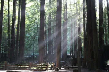
My next stop was at beautiful Devil's Lake. The area boasted not only a beautiful lake, but also stunning rock outcrops. I read that the area formed part of the Baraboo Range, which scientists believe was created 1.6 billion years ago.
Even more interesting was that I kept crossing the "Ice Age Trail," a thousand-mile footpath, entirely within Wisconsin. More than 12,000 years ago an immense flow of glacial ice formed the landscape here, making me instantly want to hike the trail. Fortunately, I refrained from doing any such thing, as hiking would require a completely different set of equipment.
Route 113 arrived at the Merrimac Ferry which crosses Lake Wisconsin. The ferry was more a barge as it was pulled across the lake by cables. I guessed using the barge was due to the lake’s shallowness, as I read it has a maximum depth of only 7.3m.
Once on the opposite side, I resumed my ride past Lodi and Dane. Shortly past Dane, a kind man stopped and offered to take my panniers to my next destination—how nice of him?
The weather was incredibly humid as I pitched the tent at DeForest. Unfortunately, I soon had to retreat into the tent to avoid being devoured by the many eager mosquitos. Although it was hot, lying in the tent was fun, especially while watching fireflies flit and glow in the darkness.
The weather was so hot, humid, and tropical that I could not for the life of me imagine winter in Wisconsin, as I understood the average temperature for December, January, and February was a mere 5°F.
De Forest – Waukesha - 135 km
Packing up was at leisure after which minor paths led me past houses displaying home-grown products for sale, which looked rather lovely.
The rest of the day was spent biking along a relaxing and fascinating bicycle path that led to Waukesha.
Waukesha, Wisconsin – Muskegon, Michigan - 22 km (Ferry)
A short ride, partly on a bike path, took me to the ferry terminal in Milwaukee, Wisconsin. En route to the ferry, I met Bob, another cyclist, who accompanied me to the ferry terminal. I was just in time to board the ferry across Lake Michigan, which came at a hefty $100 fee. However, the ferry was amazingly comfortable and fast. Two hours later, I was relieved to moor at the pier in Muskegon, Michigan. My relief was due to the countless accounts of mighty strange sightings and disappearances in and around Lake Michigan. I overnighted in Muskegon but sadly never witnessed any UFOs or bright lights in the sky.
Michigan
Muskegon – Holland - 50 km
From Muskegon, a short 50-kilometre ride took me to Holland. Although it rained for most of the day, the weather cleared by late afternoon. Holland sported a motel that provided a fast enough internet connection to reload the Garmin map, which went on the blink.
The town of Holland came as a surprise. It indeed resembled a tiny Holland, sporting windmills and wooden shoes. Shops even sold apple strudel.
Holland – Covert - 78 km
The rain-soaked ride to Covert was somewhat miserable. Fortunately, the weather wasn't cold, but thunder and lightning made me take cover at a shop. Shortly afterwards, I finished the day’s ride when I spotted a campsite in Covert, where I crawled in sopping wet.
Covert – Vicksburg - 80 km
So well did I sleep, the time was already past 8h00 before I emerged from my tent. Coffee was from a store in camp and it was already 10h30 by the time I cycled out of Covert in the direction of Vicksburg.
It was time to cross the state of Michigan and make my way towards Lake Erie. Unfortunately, no clear path headed across the state and the day was spent zig-zagging through farmlands on country roads. At one of these settlements, I met Sharon Wimple, running for state representative. On wishing her well in the elections, she put a few dollars in my hand and told me to have a meal. As this was the second time I was given money to buy food, I thought I must look somewhat scrawny. LOL.
Vicksburg had a campground on the outskirts of town, but the sites were costly. Fortunately, a welcoming chap invited me to share his stand and later, his friend also pulled in. They made a fire, and we sat around having a few beers. My hosts proceeded to get completely pissed, and I quietly slinked off to my tent. While lying there, I could hear them chatting away, getting increasingly drunk as the hours passed. Finally, I fell asleep but woke in the middle of the night with one of them sitting outside the tent telling me how much he loved me, suggesting he lay down next to me. I unzipped the tent and angrily shouted, "Fuck off!" It was uttered with such gusto that you’ve never seen a drunken man scurry that fast. LOL
Vicksburg – Jonesville - 93 km
The way to Jonesville was one more day spent zig-zagging through farmlands. Biking through the villages was preferable as they were pretty interesting but the streets running through these settlements were surprisingly narrow and busy.
On arrival in Jonesville, a reasonably priced motel lured me in. It made updating photos and journal entries easy while watching TV.
Ohio
Jonesville, Ohio – Twin Acres Campground, Swanton, Ohio - 115 km
Nothing of significance happened, and I was happy to come across a trail through the forest which provided a change of scenery. However, as soon as the path crossed the border into Ohio, I was back amidst cornfields and traditional red barns. The day dragged on a tad but, finally, the route spat me out in Swanton, exactly where I wanted to be and where I bought food from the small supermarket before pedalling to the campsite. Being Labour Day weekend, the camp was chock-a-block—fortunately, there remained space for a small tent.
Swanton – Stony Ridge - 33 km
I didn't feel like cycling, but I was stuck on the camp's outskirts, without electricity or Wi-Fi, so I packed up and rode the short distance to Stony Ridge.
Since it was Labour Day weekend, everything was again packed to capacity and nearly twice the regular price. I decided to lie low and wait for the holidays to pass before venturing further east.
Times like these are perfect for hauling out the macro lens. What I like about the Canon Macro 100 mm 1:2.8L lens is when the focus is spot on, one can zoom in and crop to your heart's content without losing detail.
Stony Ridge – Norwalk - 92 km
A cycle path followed the old original railroad between New York and Chicago, leading past the interesting communities of Elmore, Lindsey, Fremont, Clyde, Bellevue, and, finally, Norwalk. I spent two nights in Norwalk as the weather report predicted heavy storms. Nothing, however, came of the predicted bad weather except a slight drizzle.
Norwalk – Motel 6, Middleburg Heights - 77 km
The day dawned bright and sunny, but it felt like each dog in the district wanted a piece of me, especially the little ones. Soon, the road brought me to the outskirts of Cleveland and, as I did not feel like staying in the city, I took a room at Motel 6.
Motel 6 – Geneva State Park - 95 km
The ride through Cleveland was fascinating. On riding into the city centre, the route passed underneath the Hope Memorial Bridge with its ‘Guardians of Traffic’. Each of the eight guardians carved on the bridge pylons holds a different vehicle. Collectively, they represent the history of ground transport—from a stagecoach, covered wagon, and hay rack, to a 1930s-era automobile and four types of trucks. In the process, the bridge provided an excellent view of the city.
The Lakeshore path was in poor condition except for the stretch through the well-off areas. Soon, the trail reached the city's outskirts and followed the shores of Lake Erie. That night, camping was at Geneva State Park right on the lake.
Pennsylvania
Geneva State Park – Erie - 95 km
The weather was stunning as I set off along Lake Erie, and it wasn’t long before the road crossed into the state of Pennsylvania, founded in 1681 as a Quaker Community.
The day’s ride finished in Erie where I camped on the banks of the lake. It was a convenient spot, but a storm came in during the night, and I feared the tent wouldn’t be able to withstand the high wind. There was nothing I could do but crawl out in the bucketing rain, peg in the guy ropes as best I could, and return to my tent, sopping wet. Fortunately, the storm passed quickly, and although it rained throughout the night, the high winds subsided. Phew!
Erie – Dunkirk - 87 km
By morning the weather cleared, and it became a beautiful day on the bike. Not wanting to cycle to the falls in a day, I decided to split the ride into two shorter days. A leisurely ride ran through vineyards to Dunkirk and Midway. Along the way, the road led me out of Pennsylvania and across the border into New York.
New York
Dunkirk – Buffalo - 87 km
It was early September and the weather was great. The sky was bright blue, and there was no wind. I spent a good deal of the day talking to people I met along the way.
In the process, the way passed a massive wooden statue of a Native American. It’s said (sadly) that merely around 1% of the county’s population was native. Even less than Asians, Chinese, Filipinos, and Europeans.
On the outskirts of Buffalo I found a very professional-looking bicycle shop. As my bike needed a service, I booked a room nearby.
Unfortunately, the bike shop was closed on Mondays. In the meantime, I succumbed to temptation—I ordered a Canon EF 24-105mm f/4L IS USM lens, which I’ve been eyeing for a long time and couldn’t leave Buffalo until my order arrived.
The following morning, I returned to the shop where I left my sad-looking bicycle in their capable hands. My assumption that the bike would take a day or two was clearly incorrect. Waiting for the cycle was not big deal as I had to wait for the lens, and I figured I might as well take care of everything in one go.
Buffalo – Niagara Falls - 50 km
With the bike serviced and a new lens on the camera, I pedalled along the river to Niagara Falls. My efforts were well rewarded as the bike ran smoothly and the new lens was a treat.
As I got closer to the falls, the river started flowing faster, and I could see ‘smoke’ rising in the distance, adding to my excitement. Surprisingly, the area wasn't a typical waterfall type terrain as the landscape was pan-flat and lacked mountains or high cliffs. Then, as if the earth suddenly opened, the water surged over the precipice and plunged into the river below. I couldn't wait to try the new lens and almost immediately set out to the falls, where I took a gazillion photos.
Niagara Falls – Albion - 88 km
After three days I got onto the Erie Canal Trail, which runs across the state for 363 miles from the Hudson River in Albany to Lake Erie. My bicycle had just been serviced and rode as smoothly as if it were brand new (albeit $550 later!).
My new lens was on the camera, the sun was shining, and I had the benefit of a slight tailwind. Life was indeed good. I discovered the Erie Canal and overnighted in Albion—a town that owes its very existence to the canal.
Albion – Newark - 117 km
My discovery of the Erie Canal Heritage Trail, which followed the canal, made it a lovely day of biking while meeting interesting people and watching boats cruising along the channel. It looked genuinely pleasant and made me want to do the same. Digging the canal, which opened in 1825, must’ve been quite a feat in its day.
Towards the end of the day, Newark, a typical canal community, was a convenient place to pitch the tent, as the village provided amenities for the many boaters.
Newark – De Witte - 105 km
The canal had a fascinating history. Throughout the 18th and 19th centuries, the lack of an efficient and safe transportation network kept the population (and trade) primarily confined to coastal areas. For many years, explorers searched for a waterway to the west. Then, in 1807, Jesse Hawley, a prisoner in the Canandaigua Jail, wrote a series of essays proposing a waterway from Lake Erie to the Atlantic Ocean. He described the route, costs, and benefits of what would become the Erie Canal in great detail.
Today, a pleasant road runs along the canal. Squirrels darted across the path, and grey herons waded in the shallows, all while passing numerous old locks. I couldn’t help but wonder if Jessy Hawley was ever financially compensated for his efforts.
De Witt – Rome - 60 km
Even though I was not in the mood for cycling, the ride remained pleasant, offering beautiful views of the surrounding woods and the canal.
Rome was far more extensive and revealed a considerably longer history than the other settlements along the canal. While exploring the area, I learned that Rome was an ancient portage path until the Europeans arrived. This ancient trade route joined the Great Lakes and Canada via the Mohawk River to the Hudson River and the Atlantic Ocean. I then realised the Erie Canal wasn’t a new route, but the areas’ waterways had existed for eons.
Rome – St Johnsville - 87 km
The trail passed many locks, some old and a few still operating, and it was fascinating to watch boats being let through while chatting with the operators.
In St. Johnsville, camping was possible at the Marina—a lovely place on the canal. Although no more than a hamlet, St Johnsville was settled in 1725, and a church was built in 1769 ‘for the benefit of the Indians’. Once again, I was struck by the sheer audacity with which Europeans justified travelling to another part of the world, killing the local people, seizing their land, and then attempting to impose those same values on the very communities they had devastated.
St Johnsville – Schenectady - 87 km
A nearby McDonald’s served a leisurely breakfast before I continued along the canal, sometimes flush next to it and sometimes further away. The area was pleasant, and I ambled along until reaching Schenectady, another city with a long but sad history.
Schenectady – Waterford - 40 km
A short ride led to the end of the Erie Canal Trail, where I had difficulty deciding what to do next. I could follow the Hudson River north to see the fall colours or head straight to Boston, from where I planned to fly out, as there was a chill in the air. Eventually, I wasn't sure the detour north would be worth the effort, so I headed towards Boston.
Waterford – Pittsfield - 76 km
My route first led me through the historic town of Troy, a remarkably fascinating village situated at the confluence of the Hudson and Mohawk Rivers (two major waterways)—a location which made Troy the fourth wealthiest city in America around the turn of the 20th century. To this day, Troy is graced by beautiful Victorian architecture and a few elaborate private homes.
From Troy, the route headed east towards Boston. Feeling lethargic and picking up a $20 bill, I opted for a room at the Berkshire Inn.
Massachusetts
Pittsfield – Northampton - 70 km
I loaded up and pointed the bike in the direction of Boston. However, I always felt sluggish at the end of a long ride as I didn't quite want the journey to be over. Thus, I pulled into the Knight Inn, just off the cycle path, to drag the ride out for one more day.
Northampton – Worcester - 105 km
The ride to Worcester was slow as the road ran slightly uphill. Still, it remained a beautiful ride as the fall colours began to appear. Due to the many photo stops, I only reached Worcester in the late afternoon.
Worcester – Boston - 70 km
My last day of cycling in the US arrived far too soon, and a pleasant descent took me into Boston. Along a cycle path, I raced past tiny settlements and trees in full autumn colours, making my way into the heart of Boston.
I was happy and sad to reach Boston. It marked the end of my trip through the Americas, which started in Ushuaia, Argentina, many moons ago. It was time to relax, put my feet up, and look for a flight to a different part of the world—hopefully, to a place with a slightly warmer climate.
I spent a few days in Boston, exploring this pleasant city and its numerous interesting sights and organising my flight out. I meandered the city’s historic downtown, featuring well-preserved architecture where old buildings sit comfortably next to modern ones. I ambled past pricy Victorian brownstone townhouses across from the Salt-and-Pepper Bridge and along the Charles Riverbanks.
Rumours suggested that bike boxes were available at the airport, but after phoning two airlines neither had any boxes for sale. Eventually, Back Bay Cycles boxed the bicycle.
As always, the longer I stayed, the more interesting the city became. Boston was beautiful, friendly, culturally rich and far older than expected. Founded in 1630 by the English, it’s also where, between 1765 and 1783, citizens revolted against the British. Fed up with the high taxes levied by Britain, the Boston Tea Party was formed. I found this all remarkably fascinating.
Steve, the owner of the Everett Hostel, offered to take me to the shop to pick up the bicycle. He also suggested (can you believe this?) getting up at four in the morning to drive me to the airport for my flight to Jamaica. I was deeply grateful for this generous offer as getting myself and the bike to the airport wasn’t just a hassle, it was also expensive. Thank you, Steve!
Boston, USA – Montego Bay, Jamaica - By plane
I was thrilled as this was the day I was to leave the Americas in search of warmer weather. I packed my belongings into a single bag and Steve was dead on time to drive me to the airport for my flight to Jamaica via New York City. Everything went smoothly except for Delta Airlines charging me for my luggage. Only one carry-on bag was free; the first checked bag cost $25, while the bike cost an additional $150! This made the flight quite expensive, but at least they didn't weigh the luggage.
During the flight, one could see the incredibly clear blue ocean far below. The water was so clear that it was possible to see the sandy bottom. The tiny islands looked idyllic and, then suddenly, there it was - Jamaica!