
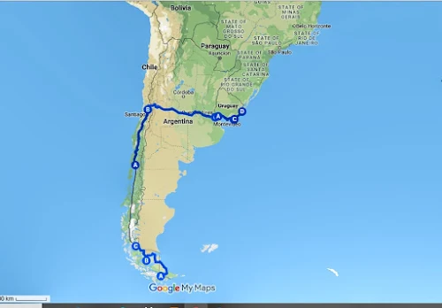
ARGENTINA & CHILE
2,950 Kilometres - 96 Days
24 November 2010 – 27
February 2011
PHOTOS - Chile
E-BOOK
35
PATAGONIA – (ARGENTINA & CHILE)
350
Kilometres - 37 Days
24
November 2010 – 31 December 2010
PATAGONIA
(ARGENTINA)
24
November - Cape Town, South Africa - Ushuaia, Argentina
I
immensely dislike flying with a bicycle and the trip to South America required
a five o’clock start to catch an early morning flight to Ushuaia via Buenos
Aires. The flight was rather long, being 9 hours and 20 minutes to Buenos Aires,
and a further 3 hours and 30 minutes to Ushuaia. On the positive side, all went
well except for having to pay the overweight baggage fee on the last leg.
A
taxi ride took me into town and to Hostel Haush, my home for the following three
nights. At last, I’d arrived at Isla Grande, Tierra Del Fuego, an island shared
with Chile and separated from the mainland by the Strait of Magellan. The
island formed the Americas’ southernmost tip, and from Ushuaia boats departed on
excursions to Antarctica.
Ushuaia
was picture pretty but understandably freezing. Fortunately, enough outdoor
stores were scattered about to stock up on warm clothes. With the sun setting
at 21h30, it felt odd going to bed when it was still light outside. By 23h00,
the time finally came to crawl in and be horizontal.
25
November – Ushuaia
Ushuaia
reminded me of Alaska’s brightly-painted, corrugated-iron roof homes and snowy
mountain backdrops. Situated on the Beagle Channel and at the foot of the Andes
Mountain Range, Ushuaia was commonly known as the most southern city in the
world. Although, with a population of a mere 64,000, Ushuaia wasn’t much of a
city. Its southern location at 54.8019° S meant artic weather year-round with a
high of barely nine degrees in the warmest months. Heating systems were thus on
year-long, including in summer!
Being
December and arriving from Australia via South Africa, I thought the conditions
particularly severe.
Having
only an inadequate pair of sandals, I made a beeline to shoe shops and spent a
small fortune on a pair of wonderfully comfortable light-weight Merrell hiking
shoes, hoping they would keep my feet warm.
The
rest of the day was spent frequenting the numerous shops and stocking up on everything
needed. The bike shop, Ushuaia Extremo, did an excellent job of reassembling the
bike.
26
November - Ushuaia – Tierra del Fuego National Park – 50 km
Dressed
in my warmest clothes (including my brand-new shoes) I biked into the National
Park. The park gate was 12 kilometres from the town centre and a leisurely ride
along a dirt road. Although bitterly cold and feeling I resembled an icicle, the
scenery was spectacular. The end of the park road indicated the end or start of
Route 3, also referred to as “The-end-of-the-world”. This might’ve been the end
of the road for many, but to me, the park marked the beginning of my route through
the Americas. After a short (and relatively quick) amble around the park, upon returning
tiny snowflakes fell from the sky. Regrettably, they melted instantly and I
can’t say I’d cycled in snow.
After
much deliberation, I purchased rain pants and a beanie to ward off the
anticipated cold weather. Both would prove well worth the expense in the months
to come.
27
November - Ushuaia – Tolhuim – 109 km
I
was cautiously excited, as this was the day I was to start my travels through
the Americas. The route headed uphill out of Ushuaia and over the mountains,
past numerous ski resorts, some even sporting chair lifts, not something I was
familiar with. The road was in good condition, somewhat narrow but sealed.
Motorists were kind and gave cyclists a wide berth and a friendly warning hoot.
After
about 50 kilometres, the route reached the top of Paso Garibaldi, featuring a
view over Lago Escondido and Lago Fagnano. Mountains provided shelter from the
wind and thus a false sense of security. The road sped downhill past Lago
Escondido and onto Tolhuim, situated on Lake Fagnano. Tolhuim was a strange
town and it was challenging to find accommodation or shops; maybe there weren’t
any. Eventually, I discovered a good enough spot to bed down.
28
November - Tolhuim – Rio Grande – 113 km
Waking
to loose, corrugated-iron roof sheets banging in the wind, one intuitively knew
the day would become a long, hard one into the wind. Heading out of Tolhuim, swirling
dust clouds made it a desolate and lonely scene. The route led north to Rio
Grande, straight into the infamous Patagonian wind. In the cold weather and
while rain pelted down, driven by a near gale-force wind, the rain hit my hands
with such force that I wished for thicker gloves. Even though dressed in all the
warm clothes I possessed, I was freezing.
As
if the weather weren’t challenging enough, the rear gear cable gave problems,
but there was nothing one could do but battle on and work with the three remaining
gears. It didn’t make much difference, as I could barely average 10 km/h. The
wind grew stronger as the day wore on, slowing the pace to a mere five km/hr.
Still, I battled on, past vast windswept and barren-looking estancias. Goals
became shorter and shorter. Four times five kilometres sounded far more doable
than 20 kilometres at that stage. Every five kilometres, I rewarded myself by
eating a sweet or biscuit. Then, head down, I headed off into the howling wind.
Midday,
a stormwater pipe running underneath the road gave shelter from the wind, if
only to give the mind a break. It’s incredible what all runs through a person’s
head sitting alone in a stormwater pipe. This was indeed a mental game and,
back on the bike, it took fighting the wind with each turn of the pedal.
Barely
20 kilometres from Rio Grande, a kind Argentinean stopped and offered me a ride.
Smelling victory over the day I declined his offer. Seeing him disappearing in
the distance, I could’ve kicked myself wondering what was wrong with me. Instead,
gripping the handlebars, I pushed down hard on the pedals.
Eventually,
Rio Grande rolled into view. Exhausted, I crawled into Rio Grande, booked into
the first available guesthouse and fell asleep exhausted but pleased to have survived
such a harsh day.
29-30
November - Rio Grande
There’s
nothing better than waking up to the smell of coffee and toast, and I eagerly
crawled out of bed. An excellent breakfast was included in the room price (in
Argentina, a typical breakfast usually consisted of coffee and croissants, or
other pastries). At least the weather cleared, but the relentless wind didn’t abate
– maybe it never does. Nothing could prepare you for what is in store,
regardless of what you read or hear about the wind. If it weren’t that Ernest
and I’d battled into storm-strength wind day upon day along the Red Sea Coast
of Egypt, I wouldn’t have believed such a wind possible.
I
could feel a bout of laryngitis coming on (maybe from breathing all the icy
air) and was pleased for a day of rest. Priority was finding a bike shop to replace
the gear cables. The friendly chap at the bike shop advised fitting off-road
tyres for the dirt road ahead. Unfortunately, he could only get the tyres the
following day. Leaving the bike at the shop was no problem as the wind speed
was between 65 and 100 kilometres per hour. (I kid you not!)
1
December - Rio Grande – 19 km
Once
the bike was fixed, I was ready to roll. Regrettably, the wind won the day. After
battling 10 kilometres out of town, I eventually gave up and returned to Rio
Grande. Cycling wasn’t simply hard but also too dangerous and scary as the wind
blew me like a rag across the highway.
Hostel
Argentino was slightly less expensive than where I’d stayed before and made an
excellent place to wait out the weather. Three more cyclists were heading in
the same direction and waiting for a break in the weather. Watching the weather
forecast, there appeared no hope of the wind subsiding. We, thus, had no other choice
but to wait. In the meantime, some fine red wine was enjoyed and war stories
swapped, which became more impressive as more wine was consumed.
2
December - Rio Grande – San Sebastian (and by car to Punta Arenas) – 38 km
The
following morning, the wind looked deceivably less fierce than the previous
day. However, after hurriedly loading up and biking out of town, I found the
wind no less violent than the day before. Battered by wind kilometre upon
kilometre, each turn of the pedal became an achievement. The wind blew in random
gusts and every so often blew me off the road and into the barren no-mans-land.
I stopped counting the times I picked myself up to try again. Worse was that it
blew me into the road. Even though drivers were extremely courteous, cycling remained
nerve-racking. If the wind wasn’t enough, the weather was freezing and, at one
point, it started hailing. Wondering if things could get any worse, the wind
gathered strength, making it near impossible to ride. All one could do was hold
on to the bike, hoping not to get blown over. God knows I must’ve made a pathetic
sight as a kind truck driver stopped and offered me a ride to San Sebastian, almost
40 kilometres away. The truck’s safety gave false security, (or pure stupidity)
and once in San Sabastian, I got back on the bike.
The
border crossing between Argentina and Chile was barely 10 kilometres away and a
low-key operation. Nevertheless, the immigration office made a sad and lonely
sight: a small, unimpressive building in a vast windswept wilderness. There was
nothing around but barren land as far as the eye could see. The immigration
office further marked the end of the paved road, adding to the region’s desolate
appearance. From there on, a dirt track ran 140 kilometres to Porvenir, from
where ferries departed to Punta Arenas. Still, it took a while before all was
checked and cleared.
From
the immigration office, the route headed straight into the wind. Walking the
bike in the high wind along that desolate and windswept stretch of road, I felt
awfully lonely and sorry for myself.
Even
pushing the bike, I was blown over and fell into a ditch. Lying in the ditch, I
looked up into the face of a llama. It appeared even the llama was surprised to
see me. I got up, dusted myself off, waved the llama goodbye and tried again. There
remained 140 kilometres to the next town, and it was time to take stock of my
dire situation. Sitting by the side of the road I had no idea how to get myself
to Porvenir. The water I had was only enough to last a day. The wind blew with
such force one couldn’t even get on the bike, let alone cycle, and I was blown
over before both feet were on the pedals.
When
a helpful Chilean driver stopped to offer me a ride to Punta Arenas, reality
set in, and I realised hard-headedness wouldn’t get me anywhere. I tried but couldn’t
see any other option but to accept his offer. The Patagonians were incredibly hospitable.
3-4
December - Punta Arenas
Once
in Punta Arenas, Hospedaje Independencia offered both camping and dorms. Being the
cheapest accommodation in town, backpackers from all over the world packed the
place. Much of the region once belonged to Jose Menendez, wool baron of his
time. Even today, the area is still sheep country, and wool and mutton remain
the region’s primary income.
Francois
(a cyclist from Hostel Argentino in Rio Grande) arrived by bus, and it felt like
meeting an old friend. Unfortunately, the weather station alerted high winds
(according to them, gusts of over 100/120 kph were possible). Therefore, staying
put and rechecking the weather the following day was best. By evening, all
huddled inside the hostel kitchen, where the owner made Pisco Sour drinks for
everyone. By the end of the evening, it didn’t feel that cold stumbling out to the
tent.
5
December - Punta Arenas – Puerto Natales – 21 km
The
weather looked much improved, and after a leisurely start, I biked out of Punta
Arenas. Still, the wind barely allowed clearing the city limits (roughly 10 kilometres)
and then hit with full force. I genuinely felt defeated and didn’t know how others
cycled in this wind (I subsequently found most waited it out). Riding was too scary
as the wind wasn’t directly from the front, but generally from the side. Furthermore,
it came in gusts, blowing one off the road or into the traffic. It was better
to admit defeat and return to town, after which I flew downwind into the city
centre.
From
Punta Arenas, a bus ride took me to Puerto Natales. Arrangements were made with
Yuta and Francois to do a trek once in Puerto Natales. However, even the bus appeared
to have difficulty staying on the road. What an unforgiving area Patagonia was.
The plains were barren, treeless and windswept. Now and then, a lonely and
forlorn-looking estancia appeared, some even deserted.
Once
in Puerto Natales, Josmar Hostel offered dorms and a well-protected campground,
making it a perfect place to arrange treks.
6
December - Puerto Natales
Francois
and Yutta arrived, and the day flew by as preparations took place for our eight-day
Torres Del Paine trek. Hiking shops rented bags and walking sticks, and we stocked
up on food. The backpacks were heavy, and I wondered if it would even be
possible to make the first few kilometres (and that was before packing the
wine). Basic stuff like a tent, sleeping bag, an eight-day food supply and warm
clothes were already a massive amount of gear.
7
December - Torres Del Paine - Las Torres – Campamento Seron
Torres
Del Paine National Park was exceptionally well organised. A 7h30 bus ran to the
park and a small minibus to Hotel Las Torres, where the first day’s hike started.
Then, heaving the heavy packs, we strolled off to our first campsite.
Our
route came with lovely views of snowy mountains and lakes. Unfortunately, our
first campsite was exposed to the elements, and the wind blew as it could only
blow in Patagonia. Somehow, we managed to cook but I was sure the tents would take
off during the night.
8
December - Torres Del Paine - Campamento Seron – Refugio Dickson
My
ankles were reasonably sore upon waking, but I paid no attention to it as minor
aches and pains usually came with the territory. In addition, I’d spent the best
of the previous four years on a bicycle and hardly ever placed any weight on my
feet and ankles. Thus, I could expect them to be slightly tender.
After
a leisurely start, a short stroll took us to our second campsite. Again, the
day turned out to be enjoyable and relaxed – it was a good thing, too, as it
started raining, a drizzle which continued for the rest of the day. On reaching
Refugio Dickson, we were wet and cold, my ankles throbbed, and walking became challenging.
Dickson was, however, one of the best camping areas on the trek. It had a
lovely refugio with a fireplace and a communal sitting area, where coffee, tea,
and a few basic meals were for sale. Inside, the refugio was social, with many wet
and cold bodies (and boots) huddled around a small fireplace. When it came to
wet boots and cold feet, hiking was the same worldwide.
Outside
the weather was bitterly cold and nowhere inside seemed warm enough, even though
I was dressed in all I had. Soon, it started snowing and the entire landscape turned
a brilliant white. The falling snow was quite a novelty initially but wasn’t as
romantic as imagined. Fearing the poor tent would collapse under all the weight,
I scraped off as much as possible.
9
December - Torres Del Paine - Refugio Dickson – Campamento Los Perros
The
trek to Refugio Dickson was another short walk, and there was no need in
rushing to pack up. Also, rumour had it that temperatures were even lower at
Dickson, and we only got underway at around 12h00.
Although
trying to ignore the pain by taking anti-inflammatories, walking became a
serious struggle. The hike nonetheless offered stunning views of glaciers and
surrounding mountains. My pace slowed, and François accompanied me as I crawled
along at a snail’s pace. Finally, I dragged myself to camp aided by my two
walking poles. It’s a terrible feeling knowing you’re holding up your fellow
hikers, but there wasn’t anything I could do. On arrival at camp, the cold
weather made it essential to get the tent pitched as soon as possible, as I
knew there would be no getting up once inside.
People
were incredibly kind and helpful, all offering painkillers and lotions.
However, I knew I could not cross the pass in the morning. The pass was a steep
climb of almost 1,000 metres in deep snow and it was at least a six-hour walk
to the next camp.
10
December - Torres Del Paine - Campamento Los Perros
I
was stuck in the tent and couldn’t move. My ankles and feet were too painful to
place weight on them, and the slightest bit of pressure sent shock waves of
pain through me. I waved Francois and Yutta goodbye and then had to think about
how to get myself out of there. My lack of the Spanish language made arranging
anything complicated. Eventually, information from Los Perros’ people was that one
could organise a horse but not from Los Perros. It would take returning to Dickson
and maybe once there staff could arrange a horse. I didn’t know how to achieve
that, as even standing was impossible.
Later
that day, a group of British horse riders arrived, and it was good to hear a
language I understood. Their guide came to my tent and offered to take my
backpack to Dickson if I could make it there on foot. I was incredibly grateful
for this immensely generous offer and decided, come hell or high water, I would
get myself to Dickson.
11
December - Torres Del Paine - Campamento Los Perros – Refugio
Two
of the horse riders were South African doctors working in London. True to
nature, they had a fair amount of medicine and offered painkillers. Thanks to
them, I could just about get out of the tent and stand on my feet.
Once
the tablets kicked in, and aided by my walking poles, the slow shuffle along
the path began. This wasn’t merely embarrassing but incredibly painful. I kept
telling myself, “It’s only pain” and my usual motto of “Even this will pass”,
but these were empty words. The pace was slow, one step at a time; not even the
painkillers seemed to help after taking almost all of them. It’s amazing what
one can do when there’s no other option. Finally, I stuck the walking poles
into the ground and dragged myself forward; a slow, painful and tedious task.
On
shuffling into Dickson, I was immensely proud of myself. It was a task which
seemed impossible just a few hours before. In Dickson, three other trekkers
were waiting for horses. Like the previous night, I thought it essential to
pitch the tent and do all the necessary tasks, like filling up with water,
getting food and going to the toilet. Once inside, there would be no getting up.
Even aided by the walking sticks, it was barely possible to keep moving until all
was done. Exhausted, I flopped into the tent.
Soon,
a fierce wind picked up and securing all tent ropes and pegs became crucial. Crawling
on all fours, I hammered in pegs and tightened strings. What a sight I must’ve
been! Still unsure if the tent would hold up in such a strong wind, I supported
it by leaning against the windy side. It blew so strong it became barely possible
to hold it up, even leaning against the side with all my weight.
12
December - Torres Del Paine - The “rescue.”
Early
morning, and quite unexpectedly, a message came that a horse had been arranged.
The only snag was that the horse was on the river’s opposite side. Even swallowing
the last four painkillers, it felt the tablets had no impact. And to think, I
always considered myself one with a high pain tolerance! Nevertheless, I got
the tent down through sheer determination and packed the backpack in the high
wind. Eventually, the camp owner came to help, and I limped off towards the
river.
Driven
by high wind, the river was a torrent and boatmen found it impossible to hook the
boat onto the overhead cable, a permanent installation across the river. By
then, both ranger and horse were waiting on the opposite side. Eventually, all
gave up and returned to the refugio. Following a hearty lunch, the men returned
to the river to check the conditions.
Eventually,
the boat got hooked onto the cable, and with my backpack on the boat, we made
it across by pulling the boat along the wire. Getting out of the boat, across
rocks, and onto the opposite bank was a slow and painful task, and I surmised
quite a spectacle but I had no ego left by then.
Eventually,
I met the very patient ranger and horse - I later discovered he was the most
experienced and longest-serving ranger in the park. Once heaved onto the horse
by strong hands, we galloped off following a horse trail, through an exceptionally
isolated part of the park. Nearly two hours later, we reached a dirt track
where an off-road vehicle awaited us. I had no idea it would be such a mission.
With
a skilful driver, we continued a fascinating ride through the park. A jeep
track went up over mountains, through rivers and marshlands and past some of
the most stunning vistas the park could offer. What an adventure, albeit a tad
uncalled for.
An
ambulance waited at the park’s main gate and, embarrassingly, I was loaded in
and taken to Puerto Natales Hospital. The fact that I’d been hiking and
sleeping in the same clothes the past five days and that each person wanted to look
closer at my feet, which had been in the same shoes and socks for the same
amount of days, was part of my embarrassment.
At
the hospital, x-rays were taken, my feet were examined, and I was declared
healthy apart from pulled ligaments and severe tendonitis. Though the doctor
indicated my injuries would take four weeks to heal, I paid little attention and
was sure I would be up and running within a day or two. Then, of course, I had the
luxury of an intravenous painkiller. Still, it never had the slightest impact.
There was no hopping and skipping out of the hospital, as anticipated.
The
time was 11 p.m. before hailing a taxi to take me the short distance to the
hostel. Then, finally, I could rest my weary feet. The total cost of rescue and
hospital came to US$470. A reasonable amount, considering what was required,
and how many people were involved in getting me out. I can only thank the
helpful and professional staff of Torres Del Paine National Park.
13-25
December - Puerto Natales
All
wasn’t well yet and, luckily, the staff at the hostel offered to get the much-needed
anti-inflammatories from the pharmacy. At last, I could shuffle to the bathroom
for a much-needed shower. Thank goodness for the laptop, which kept me occupied.
All in all, it was my fault for thinking I could do more than my body could. Following
nearly four years of cycling, my ankles were weak from a lack of walking and it
was a reminder that I should live a more balanced life.
Yuta
and François returned from their hike and they had a wonderful time. Needless to
say, I was green with envy.
I
waited and waited but healing was an excruciatingly slow process. At least anti-inflammatories
and painkillers allowed for a slow shuffle to banks and shops. Day upon day, I
waited, but progress seemed dreadfully slow. The daily shuffle to the
supermarket was a painful exercise at a snail’s pace. Finally, my friends moved
on. Still, I waited and thought it unbelievable that a common ankle injury
could take that long to heal. I was fed up and desperately wanted to get on the
road. Then, I received the sad news that severe tendonitis could take three to
six weeks to heal. This wasn’t what I wanted to hear. There are, sadly, certain
things in life one can do little about. This was one of those situations, and I
had no option but to wait.
I
woke with great anticipation each morning, only to find minimal improvement. Close
to despair and bored stiff, cycling into the wind didn’t sound all bad.
The
hostel was a favourite among young Israeli travellers, and they visited in
their hordes. They seemed to favour South America as a travel destination and
moved in packs. Seldom, if ever, did you meet an Israeli travelling solo.
And
I waited, and waited and waited!
26
December - Puerto Natales
At
last, it felt like my injuries were on the mend and walking was less painful than
before.
That
very evening, Ernest arrived from the north en route to Ushuaia. He looked
haggard from weeks of battling the wind (at least he had the wind from behind).
Harsh conditions along the Carretera Austral in Chile and the infamous Route 40
in Argentina could wear any traveller down. With much catching up to do since we
parted in Melbourne two months earlier, the chatter continued until late.
27
December - Puerto Natales
The
following morning, I sought out the ticket office to get information on the
Navimag Ferry which sailed between Puerto Natales and Puerto Montt – said to be
a spectacular three-day voyage via the Chilean fjords. I learned the weekly
ferry sailed that evening and had a cabin available. So, a quick decision was
made to take the boat, a trip I had been dreaming about for years.
Ernest
decided to throw a U-turn instead of proceeding further south. Even though the
passage was costly, it included four nights, three full sailing days, and
meals. Also, it would allow my ankles three more days to heal, but, most of
all, it would get me out of the fierce Patagonian wind and cold conditions, or
so I hoped.
The
odd thing was that boarding time was at 21h00, but the boat only sailed at 4h00
the following day. So, excited as a child to finally be on the move, I biked to
the harbour. Shortly past 21h00, we settled into our cabin on the Navimag ship,
Evangelistos. Although our cabin had four berths, we
were the sole occupants.
28
December - Puerto Natales – Puerto Montt - Day 1
Early
morning our ship sailed, and by 6 a.m., the boat was manoeuvring through narrow
passages and fjords. Snow-covered, jagged peaks surrounded us and a fierce wind
whistled by, and I was happy to watch the spectacle through my cabin porthole.
By
afternoon, the Evangelistos sailed past the vast and spectacular Glacier Amalia
and I ventured outside to snap a few pictures, albeit it being bitterly cold.
The scenery was impressive with thousands of uninhabited islands, snowy
mountain peaks and icy-looking glaciers in the distance.
We
had already had two excellent meals during the day, and at supper discovered one
could request a vegetarian main course. I was served a delicious vegetable stew
and rice with a small side salad.
29
December - Puerto Natales – Puerto Montt - Day 2
Like
the previous day, breakfast consisted of bread, porridge/eggs, cheese, ham,
fruit, yoghurt, cereal, juice, and coffee. All meals on board were excellent,
and there were more than enough.
The
captain pointed out a shrine on a small island, said to be the Guiding Spirit
of all sailors, and a shipwreck known as an insurance scam before heading out
of the channels into the rolling swells of the Pacific Ocean. When we cleared
the fjords’ protected waters, the ship began to roll wildly and it was best to
stay in one’s cabin.
Dinner
was excellent, as usual, but there were (understandably) far fewer passengers
in the dining hall, and it was somewhat tricky to balance one’s food tray on
the way to the table.
30
December - Puerto Natales – Puerto Montt - Day 3
As
before, breakfast was enjoyable, though some passengers still seemed a little
green around the gills. By midday, the Evangelistos was back in the calm waters
of channels and sailed, yet again, smoothly without us having to cling to every
conceivable stationery item.
The
early morning fog burned off and brought excellent vistas of the Southern Andes
Mountains with their jagged peaks and snowy volcanoes. The day further turned
out our first day of calm sailing and sun simultaneously. The outside upper
deck with bar/lounge was popular; by afternoon, some paler passengers resembled
well-cooked crayfish.
As
before, we stuffed ourselves at dinner time and, as any good ship would have it,
our final night came with a party.
31
December - Puerto Montt
Our
ferry docked at Puerto Montt during the wee hours of the morning, and practically
all trucks had already departed the cargo decks upon waking up. After breakfast, it was time to disembark and return to our regular lives.
A
short ride took us into the city centre and to the hospedaje where Ernest
previously stayed on his way south. In typical Chilean style, the building was
a rickety, three-level, shingle-clad home with lace curtains and wooden display
cabinets, housing all kinds of family heirlooms. It felt like I had finally arrived
in Chile proper. The elderly owner was quite interesting and had owned the home, named merely B&B, for 40 years.
Although
New Year’s Eve, our search for excitement revealed little. In general,
restaurants and bars were closed, and Chileans appeared to celebrate at home. There
were, however, spectacular midnight fireworks at the pier. Our host invited us
for a drink with his family and friends, who were busy welcoming the new year.

350 Kilometres - 37 Days
24 November 2010 – 31 December 2010
36 CHILE
1305
Kilometres - 27 Days
1
January – 27 January 2011
1–2
January - Puerto Montt
Waiting to be 100% confident on my feet, I spent two more days in pretty Puerto Montt. I lay watching TV while Ernest polished off two bottles of whiskey and a
case of beer. I realised nothing had changed and wondered how long it would
take me to face reality!
Puerto
Montt’s weather was relatively mild, and I was happy to be out of Patagonia.
Unfortunately, Patagonia wasn’t as picturesque as predicted. All I remember was
a ferocious wind and a hike that went very wrong.
By
afternoon, a reasonably strong earthquake hit Chile. Mercifully, it occurred
pretty far north, and only a moderate tremble was felt in Puerto Montt. Our
rickety guesthouse swayed from side to side, but luckily, no damage was done.
Surprisingly, no one seemed perturbed about it.
3
January - Puerto Montt – Puerto Varas – 20 km
The
short ride to picturesque Puerto Varas was my first cycle in a long while.
Founded by German settlers and still known for its strong German
traditions, Puerto Varas was picture-postcard pretty. The area was highly
touristy due to its location on the shore of Llanquihue Lake, its unmistakably
Germanic architecture, pretty residential neighbourhoods, and well-tended
gardens.
Scenic
places are bound to have hordes of backpackers, fancy hotels and pricey
restaurants. Regrettably, the weather was overcast and drizzling. Thus, there
was no glimpse of the famed Osorno volcano or the snow-capped peaks of Mt
Calbuco and Mt Tronador from across the lake.
I
was happy that my ankles held out and felt more confident about continuing my travels.
Walking caused some discomfort, but biking caused no problems.
4
January - Puerto Varas – Frutillar – 43 km
Frutillar
was the next settlement on the lake, and another town founded by German
settlers in 1852/6. During this time, countless German settlers arrived under
the official colonisation programme of Southern Chile.
Frutillar
had no camping on the shores of the lake, but we found a lovely spot in
someone’s garden under a large cherry tree. I was happy the second day of
cycling went well without any aches or pains.
5
January - Frutillar – Osorno – 70 km
One
couldn’t wish for a better start to a recovery ride. Route 5, or the
Pan-American Highway, was in excellent condition with a broad shoulder. A
tailwind, as well as beautiful sunny weather, made it effortless riding.
It
was the first time it became possible to cycle in short sleeves in quite a
while. I was even more delighted to find lodging in the centre of Osorno. The
place had an excellent ground-floor room, with a door leading to a garden, TV
and hot shower. Osorno wasn’t on many travellers’ lists, but it made a perfect
overnight stop on the way north. A walk around town revealed typical wooden
houses, an imposing cathedral, and a fort.
6
January - Osorno – Los Lagos – 95 km
Route
5 was Chile’s longest road and ran 3,364 kilometres from Peru in the north to
Puerto Montt in the south and formed part of the Pan-American Highway. We
followed this road north, and another perfect day was spent riding Chile’s lake
district. The weather was warm, with a slight tailwind, and our path ran past
forested areas with the Andes mountains as a backdrop.
A
short detour led to the small and untouristy village of Los Lagos. Situated on
the Calle-Calle River, it consisted of a quaint community with ramshackle accommodation
in the town centre. I loved these small villages with their central plazas busy
with people and bounded by streets dotted with municipal buildings, churches,
and a few shops.
7
January – Los Lagos – Loncoche – 84 km
Once
across the Rio San Pedro, Route 5 continued north through a eucalyptus forest. A mild tailwind made cycling comfortable and enjoyable. The weather was
warm, and the way gently undulating, past densely forested areas and vistas of
snow-capped volcanos. Needless to say, I was thrilled to be out riding.
Roadside cheese stalls made for convenient shopping, and the rest of the way
was spent dreaming up ways of enjoying it.
Eighty-four
kilometres further was the tiny hamlet of Loncoche, which boasted excellent
lodgings in the town centre (outside and ground floor). Loncoche was a typical
small Chilean town with a plaza surrounded by municipal buildings and a church.
Ernest
returned from the supermarket with a bag of salad ingredients and made a noodle salad, adding heaps of cheese.
8-9
January - Loncoche – Temuco – 88 km
Clear
skies, sunshine and the lack of a headwind made it a perfect day for bicycle
touring. I wore a big grin as I knew my luck had to change sometime. Following a
leisurely 88 kilometres, the town of Temuco came into view. It took a tad
longer than usual to find outside ground-floor space, preferred to being cooped
up on the third floor with no external windows.
Temuco
was a pleasant city with a leafy square, making it an easy choice to stay the following day. A non-cycling day usually came with the regular chores of laundry
and the Internet. The municipal market sold typical Chilean cheese, fruit, fish
and meat. Horse butcheries, something foreign to me, were plentiful.
10
January - Temuco – Collipulli – 102 km
Despite a mild headwind in the afternoon, the day was still a super day of biking. The
cold south had softened us up, and we needed loads of sunscreen. However,
being in warm weather without a howling wind was indeed a pleasure.
The
small town of Collipulli was up next and came with the historical Malleco
Viaduct, today a national monument. The bridge consisted of a railway bridge
built in 1890, the world's highest such bridge. I loved these little
villages where people went about their lives without the influence of tourists.
Collipulli had a central park/plaza, colourful wooden houses, a market, a church,
and a town hall. A guesthouse in the centre made it an excellent place to chill
out after a day on the bike.
11
January - Collipulli – Los Angeles – 77 km
Blue
skies abounded and the sun was out, making biking the Pan Americana Highway (Route
5) a delight. The route to Los Angeles ran through a wooded area with
substantial rivers and a few camping areas.
As in the previous days, we encountered plenty of roadside food stalls, frequented
mainly by truck drivers. Closer to Los Angeles, the countryside became more
rural with vast farmlands. Not to be confused with Los Angeles, USA, this
was an agricultural town with the highest rural population of any Chilean
municipality.
Los
Angeles was close to Laguna del Laja National Park and, as a result, a jumping-off point for those wishing to visit the park. The previous year’s
earthquake hit the region hard, and the town was still recovering. Rebuilding
was in progress, but sadly, several buildings were still in ruins. Our abode
came with a TV and a BBC news channel, and it seemed not an awful lot was
missed. It was amusing to see what the BBC considered world news.
12-13
January - Los Angeles - Chillan – 113 km
After
making a few sandwiches, the time was eleven o’clock - nothing unusual in
Chile. People went to bed late and only got going at around 10 a.m. Ernest
spotted a welding shop and had his bike’s front rack repaired - it broke on the
gravel roads along the infamous Route 40 when he was blown off his bicycle.
Our
route ran north past densely wooded areas, waterfalls, and viewpoints. Chillán was another town in a rich agricultural region, on a vast plain between the Andes Mountains and the coast. The town, with its cobblestone lanes, is said to be Bernardo O’Higgins’s birthplace. O’Higgins, regarded as
Chile’s liberator, was the driving force behind Chile’s independence from
Spain.
Chillan
had a relaxing vibe with numerous squares and parks; in fact, it was so
tranquil that we stayed for two days. The town had a beautiful town centre with a
mall, charming street-side cafes, and a sizeable open-air street market.
Because Chillan is situated in a seismic region, it has suffered devastating
earthquakes throughout its history. Earthquakes partially destroyed the town in
1742 and in 1928. Chillan was further hit by the 2010
earthquake (magnitude 8.8), which again caused severe damage. During our visit
in 2011, the destruction was clearly visible, and our abode was slanting to
such a degree that one could easily roll out the door.
14
January - Chillan - Linares – 109 km
Signboards
indicated 400 kilometres to Santiago, and that we found ourselves in Central
Chile. It indeed looked like such while biking past large farming areas on
central Chile’s fertile plains.
After
turning off to Linares, a cycle path led into town. I was surprised by the
number of historical buildings; unfortunately, the majority were still
off-limits due to the 2010 earthquake. However, close to the town square was
the Cathedral Church of San Ambrosio de Linares, one of the most beautiful
buildings in town. This was indeed a Roman Catholic country. Again, I spotted a
surprising number of cathedrals for such a small village.
After
locating an affordable establishment with cable TV (for Ernest) and bike storage, Ernest, as usual, lit his petrol stove and cooked pasta. The cooking
process took place in the bathroom; not very hygienic, but delicious,
nevertheless.
15
January - Linares - Talca – 56 km
The
day came with a slight headwind which hampered our efforts. After 56 kilometres
and feeling lethargic, Talca, situated in the Maule region, the largest
wine-growing region in Chile, made a perfect overnight stop—it was time to
taste their wine.
Talca
wasn’t only home to several wineries, but also a university, which sounded
pretty good to me. Regrettably, Talca was another place severely damaged by the
February 2010 earthquake. All budget digs in the older part of town had been
destroyed, and empty lots remained where those hostels once stood. It was quite
shocking to see such devastation.
For
the past three days, our overnight lodging was in towns affected by the
previous year’s earthquake - Chillan, Linares and Talca. Even at the recently
re-opened hotels, the open doors didn’t close, and the closed doors couldn’t be
opened. Seeing the collapsed buildings and empty plots remained a sad sight.
There
wasn’t much to do in Talco but walk to the Santa Isabel supermarket (in all
towns) to get supplies to make supper. I guessed earthquakes weren’t new to
that area as I learned the name Talca means thunder or a volcanic eruption in
the Mapuche language.
16
January - Talca - Curico – 73 km
On
departing Talco, a good tailwind assisted us to Curico. The day looked
promising until a loud bang brought us to a sudden halt. Thank goodness, it was
merely Ernest’s tyre that had a blowout but I almost hit the deck and started
leopard crawling (I’m South African, after all).
The
rest of the day was enjoyable riding through a wine region, and the farms
passed very much resembled those at home in the Western Cape. On reaching
Curico, the pleasant Hotel Prat lured us in. The place was rather convenient
with its guest kitchen and outside ground-floor quarters.
As
with the other towns in the area, Curico was destroyed by an earthquake in 1928
and severely damaged by the previous year’s quake. Fortunately, the Plaza de
Armas (the main square) remained intact and the most frequented place due to
its trees and pretty historic bandstand.
Curico
is situated 46° north. The sun sets after 9 p.m. and it darkens around 10 p.m.,
making for long summer days. I, therefore, understood their need to have long
siestas, as virtually all shops were closed between 12 and 4 p.m.
17
January - Curico - Rancangua – 112 km
Heading
to Rancangua was a pleasant day of biking. Vineyards stretched as far as the
eye could see, with the ever-present Andes to the east. Following a few cold-drink
stops, we slinked into Rancagua. I didn’t expect much of the town but was
pleasantly surprised.
Rancagua
had a historical section with an ensemble of old buildings. The town was a fair
size with a pleasant central square known as Plaza of the Heroes where the
Battle of Rancagua occurred. It is referred to as the Disaster of Rancagua, as O’Higgins
and his army had to beat a hasty retreat here and hide in nearby caves while
fighting for independence.
18-23
January - Rancagua - Santiago – 92 km
Santiago
(population around six million) was one of the most convenient capital cities
to pedal into. Next to the highway, a service road led straight into the city
centre. Ernest knew precisely where to go, as he flew into Santiago from
Australia a few months prior. All this made riding to Hostel Chile Inn
comfortable - where Ernest stayed before heading south.
Barrio
Brazil, a district close to the city centre and within comfortable walking
distance of almost everything, housed a few hostels. The underground metro
railway station was barely 100 metres from the door and made for easy
exploring. The metro could take you practically anywhere in the city and was reasonably
inexpensively.
Our
hostel was one of the many old three-storey buildings in the area. Nearly all of
these buildings came with soaring ceilings and huge rooms. I understood these
were former grand homes, generally with upper decks and ground-floor
courtyards. The staff at the hostel was super hospitable and invited all to a
free barbeque on the deck. We danced the Macarena till the wee morning hours
with the staff and a broad mixture of guests (Italians, Germans, Brazilians,
Venezuelans, Mexicans, and Chileans).
The
subsequent days were spent wandering around town, enjoying the novelty of
taking the underground and the funicular up the San Cristobal hill. Besides a
statue of the Virgin Mary, the viewpoint offered panoramic vistas of the surrounding
areas.
My
laptop gave me endless trouble, and I handed it in to be repaired, but on
receiving it found it still faulty. I took the computer to a more reliable
store and was told it would only be ready on the Monday. Upon receiving it, I
found it only spoke Spanish. After rushed last-minute shopping, we were all set
for our final stretch in Chile before heading over the Andes to Argentina.
25
January - Santiago - Los Andes – 81 km (+3km through the tunnel)
After an entire week in Santiago, Ernest and I finally resumed our journey. Soon
after leaving, the landscape changed abruptly. Gone were the wooded areas, and I
was surprised to find myself in a desert-like landscape.
The
route north to Los Andes was via a reasonably steep climb over the mountain in
sweltering weather. Fifty-five kilometres after biking out of Santiago, a
tunnel prevented cyclists from proceeding any further. Tunnel staff quickly
spotted us, came to the rescue with a truck and dropped us on the opposite
side. A pleasant descent led to the Los Andes Valley, where a small roadside
establishment with a beautiful lawn got our attention. Seeing they had a
campground out back and sold homemade bread made staying a no-brainer.
26
January - Los Andes - Roadside camping – 50 km
The
following morning our path headed mostly uphill. As expected, our pace slowed
considerably, as we stopped numerous times to snap a few pics and fill our
water bottles. By the end of the day, camping was on a hill above an emergency
truck stop with excellent views of the surrounding mountains.
The
adjacent cascading stream from the snowy mountains provided fresh water. Even
without a single alcoholic drink, Ernest washed in the river’s icy waters. It
was still early, and a relaxing afternoon was spent enjoying the sunshine. That
evening, while having supper, a jackal came trotting past. Soon it became pitch
dark and a zillion stars lit the sky—truly magical moments.
27
January - Roadside camp, Chile - Puente Del Inca, Argentina – 40 km
This
was the day the route crossed the Andes into Argentina. The road zig-zagged
up the pass and, though the gradient was acceptable, it remained a steep and
dreadfully slow 22-kilometre climb from where we had spent the night. Roadworks
caused lengthy delays and provided a much-needed break.
Finally, after huffing and puffing to the top, one could look down at the
winding road coming up the mountain, and I could hardly believe I had made it up
the pass. After reaching the top and yet another ride by the authorities
through a tunnel, 18 kilometres remained to the customs office.
The
border crossing was uneventful, and immigration staff simultaneously stamped
people out of Chile and into Argentina. From the immigration office, the path
descended past the small settlement of Las Cuevas with no more than a few
timber restaurants and a strong smell of lentil soup. Upon crossing the border,
Ernest and I reached the end of Patagonia and the beginning of Chile. After my disastrous start
in the Americas, Chile was a welcome change and a relaxing and rewarding ride.
To this day, I claim Patagonia will never see me again. LOL.

